File:Jasło location map.png

Original file (2,214 × 1,799 pixels, file size: 2.14 MB, MIME type: image/png)
Captions
Captions
Summary edit
| Description |
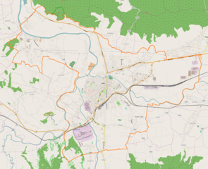
English: Location map |
| Date | |
| Source | Own work |
| Author | Smat |
| Description |
Polski: Mapa Jasła, Polska
English: Map of Jasło, Poland |
|||||||||
| Date | ||||||||||
| Source | You may find a page on the OpenStreetMap wiki page for Jasło | |||||||||
| Creator |
OpenStreetMap contributors OpenStreetMap contributors |
|||||||||
| Permission (Reusing this file) |
OpenStreetMap data is available under the Open Database License (details). Map tiles are licensed under the Creative Commons Attribution-ShareAlike 2.0 license (CC-BY-SA 2.0).
This file is licensed under the Creative Commons Attribution-Share Alike 2.0 Generic license.
|
|||||||||
| Geotemporal data | ||||||||||
| Bounding box |
|
|||||||||
| Georeferencing | If inappropriate please set warp_status = skip to hide. | |||||||||
Licensing edit
| This work contains information from OpenStreetMap, which is made available under the Open Database License (ODbL).
The ODbL does not require any particular license for maps produced from ODbL data. Prior to 1 August 2020, map tiles produced by the OpenStreetMap Foundation were licensed under the CC-BY-SA-2.0 license. Maps produced by other people may be subject to other licences. |
File history
Click on a date/time to view the file as it appeared at that time.
| Date/Time | Thumbnail | Dimensions | User | Comment | |
|---|---|---|---|---|---|
| current | 08:29, 27 July 2017 | | 2,214 × 1,799 (2.14 MB) | Smat (talk | contribs) | User created page with UploadWizard |
You cannot overwrite this file.
File usage on Commons
There are no pages that use this file.
File usage on other wikis
The following other wikis use this file:
- Usage on pl.wikipedia.org
- Jasło
- Muzeum Regionalne w Jaśle
- Jasło (stacja kolejowa)
- Wielka Synagoga w Jaśle
- Bryły
- Gamrat
- Cmentarz żydowski w Jaśle
- Jasło Niegłowice
- I Liceum Ogólnokształcące im. Króla Stanisława Leszczyńskiego w Jaśle
- Kolegiata Wniebowzięcia Najświętszej Maryi Panny w Jaśle
- Jasło Towarowa
- Parafia Matki Bożej Królowej Świata w Jaśle
- Parafia Miłosierdzia Bożego w Jaśle
- Parafia Najświętszego Serca Pana Jezusa i Niepokalanego Serca Najświętszej Maryi Panny w Jaśle
- Parafia Chrystusa Króla w Jaśle
- Parafia Dobrego Pasterza w Jaśle
- Parafia Matki Bożej Częstochowskiej w Jaśle
- Parafia św. Antoniego Padewskiego w Jaśle
- Parafia św. Stanisława w Jaśle
- Parafia Wniebowzięcia Najświętszej Maryi Panny w Jaśle
- Cmentarz wojenny nr 24 – Jasło
- Cmentarz wojenny nr 36 – Podzamcze
- Cmentarz wojenny nr 22 – Jasło
- Cmentarz wojenny nr 23 – Jasło
- Cmentarz wojenny nr 37 – Krajowice
- Lądowisko Ikar Jasło
- Las Niegłowicki
- Moduł:Mapa/dane/Jasło
- Kościół św. Stanisława w Jaśle
- Kościół Matki Bożej Królowej Świata w Jaśle
- Wikipedysta:Telgam/Telgam
- Kościół i klasztor Franciszkanów w Jaśle
- Hankówka
- Gądki (Jasło)
- Niegłowice (Jasło)
- Nowy Żółków
- Brzyszczki
- Kaczorowy (Jasło)
- Sobniów (Jasło)
- Kowalowy (Jasło)
- Warzyce (Jasło)
- Gliniczek (Jasło)
- Krajowice (Jasło)
- Jasło Fabryczne
- Muzeum Lizaka w Jaśle
- Pałac Sroczyńskich w Jaśle
- Pomnik Żołnierzy Wyklętych w Jaśle
- Dwór Lisowieckich w Jaśle
- Usage on pl.wikibooks.org
- Usage on pt.wikipedia.org
View more global usage of this file.