File:Jean-Francois Champollion - Plan Des Ruines De Sais.png

Size of this preview: 422 × 599 pixels. Other resolutions: 169 × 240 pixels | 338 × 480 pixels | 541 × 768 pixels | 722 × 1,024 pixels | 1,749 × 2,481 pixels.
Original file (1,749 × 2,481 pixels, file size: 79 KB, MIME type: image/png)
Captions
Captions
Add a one-line explanation of what this file represents
Summary
edit
| Description |
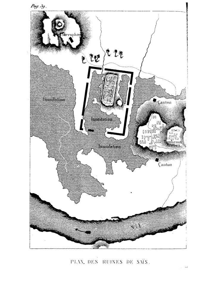
English: Map of Sais (Sa el-Hagar) ruins, Egypt, drawn by Jean-François Champollion during his expedition in 1928. Inscriptions, from top to bottom and left to right: sarcophage (sarcophagus), inondation (flooded), canton (military position?), tombeaux arabes (arab tombs), Nil (Nile).
Français : Plan des ruines de Saïs (Sa El-Hagar), en Égypte, dessinées par Jean-François Champollion lors de son expédition de 1928. Inscriptions, de haut en bas et de gauche à droite: sarcophage, inondation, canton, tombeaux arabes, Nil. |
| Date |
English: September 1828
Français : Septembre 1828 |
| Source |
"Lettres écrites d'Égypte et de Nubie en 1828 et 1829", Champollion, Jean-François, 1868 http://gallica.bnf.fr/ark:/12148/bpt6k103771z.image.f45 |
| Author | Jean-François Champollion (1790–1832) |
| Other versions |
 Cropped version Cropped version |
Licensing
edit
|
This is a faithful photographic reproduction of a two-dimensional, public domain work of art. The work of art itself is in the public domain for the following reason:
The official position taken by the Wikimedia Foundation is that "faithful reproductions of two-dimensional public domain works of art are public domain".
This photographic reproduction is therefore also considered to be in the public domain in the United States. In other jurisdictions, re-use of this content may be restricted; see Reuse of PD-Art photographs for details. | ||||
File history
Click on a date/time to view the file as it appeared at that time.
| Date/Time | Thumbnail | Dimensions | User | Comment | |
|---|---|---|---|---|---|
| current | 23:33, 1 June 2009 | | 1,749 × 2,481 (79 KB) | Xhienne (talk | contribs) | {{Information |Description={{en|1=Map of Sais (Sa el-Hagar), Egypt, drawn by Jean-François Champollion during his expedition in 1928.}} {{fr|1=Plan des ruines de Saïs (Sa El-Hagar), en Égypte, dessinées par Jean-François Champollion lors de son expé |
You cannot overwrite this file.
File usage on Commons
The following page uses this file:
File usage on other wikis
The following other wikis use this file:
- Usage on fr.wikipedia.org
- Usage on sw.wikipedia.org