File:John Speed - Map of Landaffe.png

Size of this preview: 785 × 599 pixels. Other resolutions: 314 × 240 pixels | 629 × 480 pixels | 1,006 × 768 pixels | 1,091 × 833 pixels.
Original file (1,091 × 833 pixels, file size: 1.96 MB, MIME type: image/png)
Captions
Captions
Add a one-line explanation of what this file represents
Summary edit
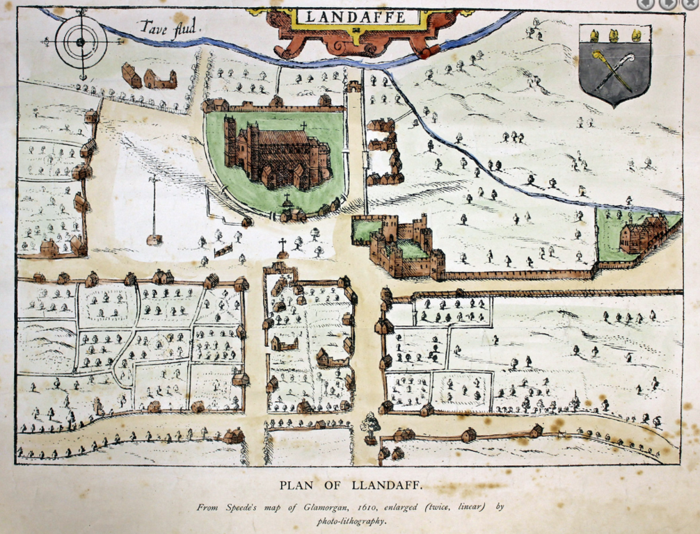
| Description | Llandaff, Wales, 1610 | ||||
| Date | |||||
| Source | cardiffparks.org.uk/ | ||||
| Author | John Spped | ||||
| Permission (Reusing this file) |
|
||||
| Other versions | |||||

File history
Click on a date/time to view the file as it appeared at that time.
| Date/Time | Thumbnail | Dimensions | User | Comment | |
|---|---|---|---|---|---|
| current | 20:50, 7 June 2022 | | 1,091 × 833 (1.96 MB) | Seth Whales (talk | contribs) | {{Information |Description=Llandaff, Wales, 1610 |Source=[http://www.cardiffparks.org.uk/otheropenspaces/bishopspalace/index.shtml cardiffparks.org.uk/] |Date=2022-06-07 |Author=John Spped |Permission={{PD-old-70-1923}} |other_versions= }} Category:Wales in the 17th century Category:History of Cardiff Category:Llandaff Category:Maps of Cardiff Category:Maps of Wales by John Speed |
You cannot overwrite this file.
File usage on Commons
The following 2 pages use this file:
.png)
File usage on other wikis
The following other wikis use this file:
- Usage on en.wikipedia.org