File:Joinville-le-Pont map.svg

Size of this PNG preview of this SVG file: 587 × 600 pixels. Other resolutions: 235 × 240 pixels | 470 × 480 pixels | 752 × 768 pixels | 1,002 × 1,024 pixels | 2,004 × 2,048 pixels | 1,552 × 1,586 pixels.
Original file (SVG file, nominally 1,552 × 1,586 pixels, file size: 541 KB)
Captions
Captions
Add a one-line explanation of what this file represents
Summary edit
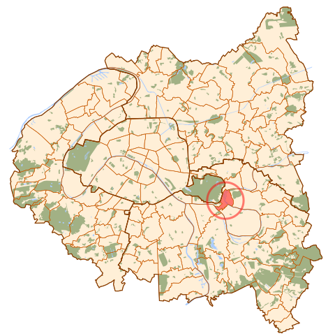
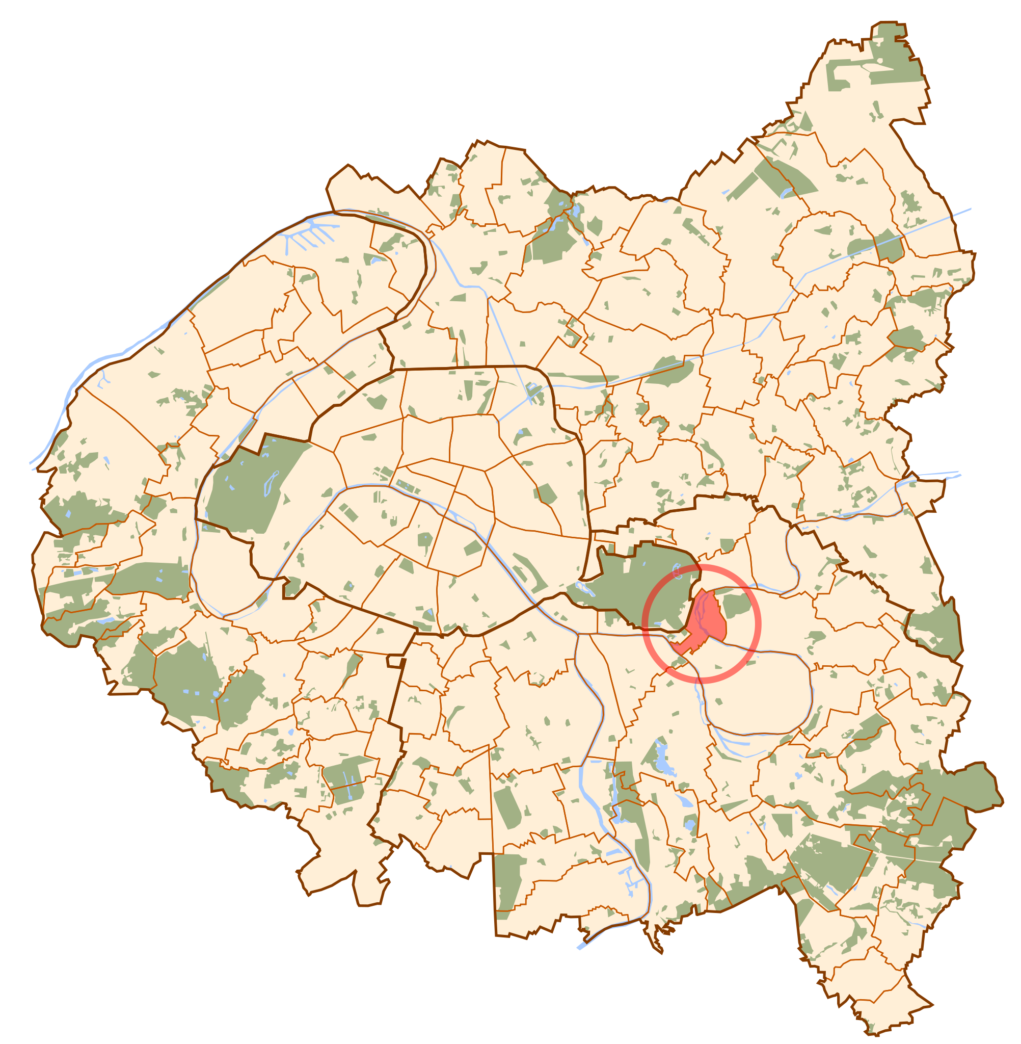
| Description | Map of Paris and its inner ring départements, localization of Joinville-le-Pont (Author: Metropolitan). |
| Date | 5 October 2006 (original upload date) |
| Source | No machine-readable source provided. Own work assumed (based on copyright claims). |
| Author | No machine-readable author provided. Metropolitan~commonswiki assumed (based on copyright claims). |
Licensing edit
| I, the copyright holder of this work, release this work into the public domain. This applies worldwide. In some countries this may not be legally possible; if so: I grant anyone the right to use this work for any purpose, without any conditions, unless such conditions are required by law. |
File history
Click on a date/time to view the file as it appeared at that time.
| Date/Time | Thumbnail | Dimensions | User | Comment | |
|---|---|---|---|---|---|
| current | 00:39, 10 October 2006 | | 1,552 × 1,586 (541 KB) | Metropolitan~commonswiki (talk | contribs) | |
| 14:19, 5 October 2006 |  | 1,552 × 1,586 (525 KB) | Metropolitan~commonswiki (talk | contribs) | Map of Paris and its inner ring départements, localization of Joinville-le-Pont (Author: Metropolitan). Category:Locator maps for municipalities of Val-de-Marne |
You cannot overwrite this file.
File usage on Commons
The following 8 pages use this file:
- Category:Births in Joinville-le-Pont
- Category:Deaths in Joinville-le-Pont
- Category:Joinville-le-Pont
- Category:Maps of Joinville-le-Pont
- Category:Monuments historiques in Joinville-le-Pont
- Category:People of Joinville-le-Pont
- Category:Sports in Joinville-le-Pont
- Category:Transport in Joinville-le-Pont
File usage on other wikis
The following other wikis use this file:
- Usage on br.wikipedia.org
- Usage on ca.wikipedia.org
- Usage on en.wikipedia.org
- Usage on eo.wikipedia.org
- Usage on es.wikipedia.org
- Usage on eu.wikipedia.org
- Usage on fi.wikipedia.org
- Usage on ms.wikipedia.org
- Usage on no.wikipedia.org
- Usage on pl.wikipedia.org
- Usage on ro.wikipedia.org
- Usage on simple.wikipedia.org
- Usage on tt.wikipedia.org
- Usage on www.wikidata.org