File:Junction of firebreaks - looking east - geograph.org.uk - 1024089.jpg
No higher resolution available.
Junction_of_firebreaks_-_looking_east_-_geograph.org.uk_-_1024089.jpg (640 × 480 pixels, file size: 111 KB, MIME type: image/jpeg)
Captions
Captions
Add a one-line explanation of what this file represents
Summary
edit
| Description |
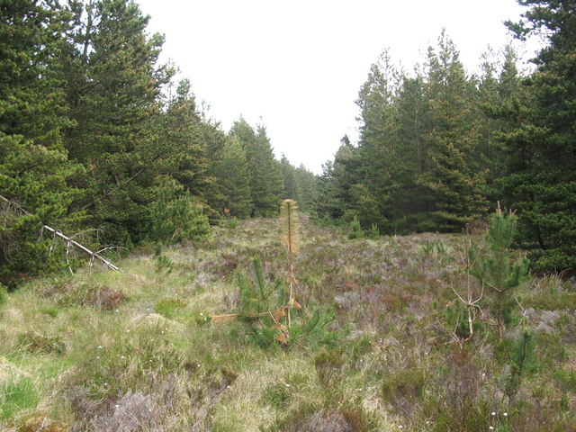
English: Junction of firebreaks - looking east. Another firebreak starts at this point, leading towards the south (to the right, in this photo); see: 1024095.
Compare 442487, taken nearby. For walkers, these might look like conveniently clear lanes; however, that is not their primary purpose, and fallen trees can make them almost impassible in places. There were no signs here of regular use by walkers (likewise, I encountered various obstructions, convincing me that it is better simply to go around the edge of the forest). The wide "lanes" of these firebreaks are to be distinguished from the very different, and perfectly usable, forest tracks that are located to the north. See, e.g., 460707. |
| Date | |
| Source | From geograph.org.uk |
| Author | Lairich Rig |
| Attribution (required by the license) | Lairich Rig / Junction of firebreaks - looking east / |
| Camera location | | View this and other nearby images on: OpenStreetMap |
|---|
_heading:67.00&language=en)
| Object location | | View this and other nearby images on: OpenStreetMap |
|---|
_heading:67.00&language=en)
Licensing
edit

|
This image was taken from the Geograph project collection. See this photograph's page on the Geograph website for the photographer's contact details. The copyright on this image is owned by Lairich Rig and is licensed for reuse under the Creative Commons Attribution-ShareAlike 2.0 license.
|
This file is licensed under the Creative Commons Attribution-Share Alike 2.0 Generic license.
Attribution: Lairich Rig
- You are free:
- to share – to copy, distribute and transmit the work
- to remix – to adapt the work
- Under the following conditions:
- attribution – You must give appropriate credit, provide a link to the license, and indicate if changes were made. You may do so in any reasonable manner, but not in any way that suggests the licensor endorses you or your use.
- share alike – If you remix, transform, or build upon the material, you must distribute your contributions under the same or compatible license as the original.
File history
Click on a date/time to view the file as it appeared at that time.
| Date/Time | Thumbnail | Dimensions | User | Comment | |
|---|---|---|---|---|---|
| current | 14:32, 23 February 2011 | | 640 × 480 (111 KB) | GeographBot (talk | contribs) | == {{int:filedesc}} == {{Information |description={{en|1=Junction of firebreaks - looking east Another firebreak starts at this point, leading towards the south (to the right, in this photo); see: 1024095. Compare 442487, taken nearby. For w |
You cannot overwrite this file.
File usage on Commons
There are no pages that use this file.