File:Juranagelfluh Obermiozaen Tengener-Rinne Tengen Schwaebische-Alb.jpg
Original file (1,800 × 1,200 pixels, file size: 3.27 MB, MIME type: image/jpeg)
Captions
Captions
Summary
edit
| Description |
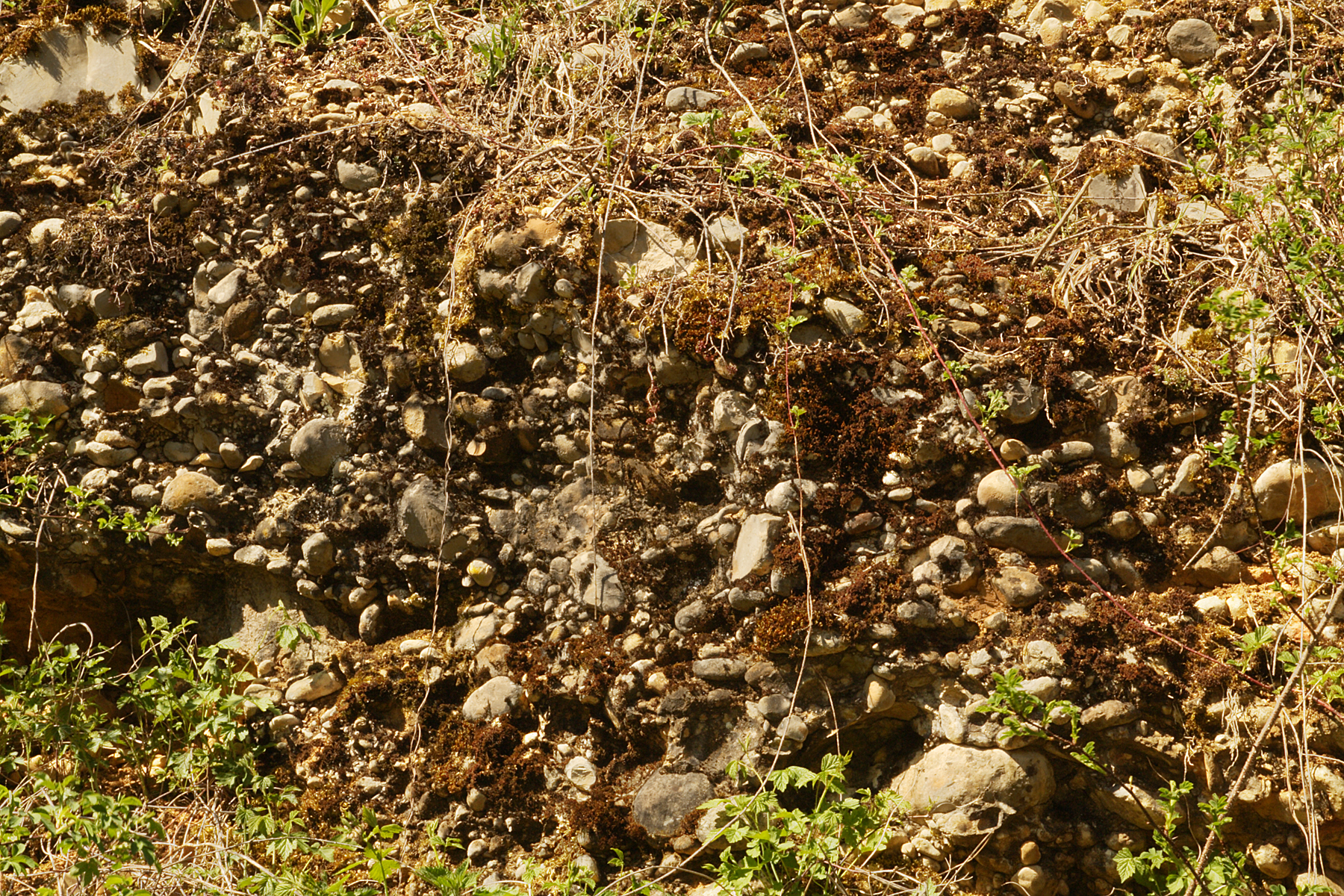
Deutsch: „Jüngere Juranagelfluh“, hier als verbackenesKonglomerat in der „Tengener Rinne“ der Hegaualb, Schwäbische Alb. Es handelt sich um meist gut gerundete sehr alte Flussgerölle, die in einer Matrix aus meist vermengten, feineren Bestandteilen wie Weißjura-Kalk, Mergel, Sand, Schluff oder Ton zementiert sind. Lang wirkende Verwitterungsprozesse können auch humose Strukturen geschaffen haben, in welchen sich Pflanzen entwickeln können. In der „Tengener Rinne“ wurden Massen von aus dem Schwarzwald stammenden Flussgeröllen transportiert. Sie ist die größte von drei gewaltigen Urflüssen, „an der Straße Uttenhofen-Tengen 200 m breit und 70 m tief.“ A. Schreiner, 1965, S. 328. Das Foto zeigt einen Teil des Konglomerats dieser Rinne. English: “Jüngere Juranagelfluh”, Middle Miocene, cobbles, a fluvial sediment of the West-Swabian Alb. The cobbles came in chutes from the north (Black Forest, northern foreland and Swabian Alb), associated with “Obere Süßwassermolasse” (Upper Freshwater Molasse). The cobbles came in such tremendous quantities, they produced three giant “runnels”. The dominant being the “Tengen runnel”, of which this photo shows a detail of conglomerates. The deposits piled up to 350 m hight, covering a plain ca. 30 km wide. |
| Date | |
| Source | Own work |
| Author | Ustill |
Licensing
edit
- You are free:
- to share – to copy, distribute and transmit the work
- to remix – to adapt the work
- Under the following conditions:
- attribution – You must give appropriate credit, provide a link to the license, and indicate if changes were made. You may do so in any reasonable manner, but not in any way that suggests the licensor endorses you or your use.
- share alike – If you remix, transform, or build upon the material, you must distribute your contributions under the same or compatible license as the original.

File history
Click on a date/time to view the file as it appeared at that time.
| Date/Time | Thumbnail | Dimensions | User | Comment | |
|---|---|---|---|---|---|
| current | 16:28, 29 July 2018 | | 1,800 × 1,200 (3.27 MB) | Ustill (talk | contribs) | User created page with UploadWizard |
You cannot overwrite this file.
File usage on Commons
There are no pages that use this file.
File usage on other wikis
The following other wikis use this file:
- Usage on de.wikipedia.org