File:Kòrọ́ọ̀tún.jpg

Size of this preview: 270 × 600 pixels. Other resolutions: 108 × 240 pixels | 216 × 480 pixels | 345 × 768 pixels | 461 × 1,024 pixels | 1,800 × 4,000 pixels.
Original file (1,800 × 4,000 pixels, file size: 2.71 MB, MIME type: image/jpeg)
Captions
Captions
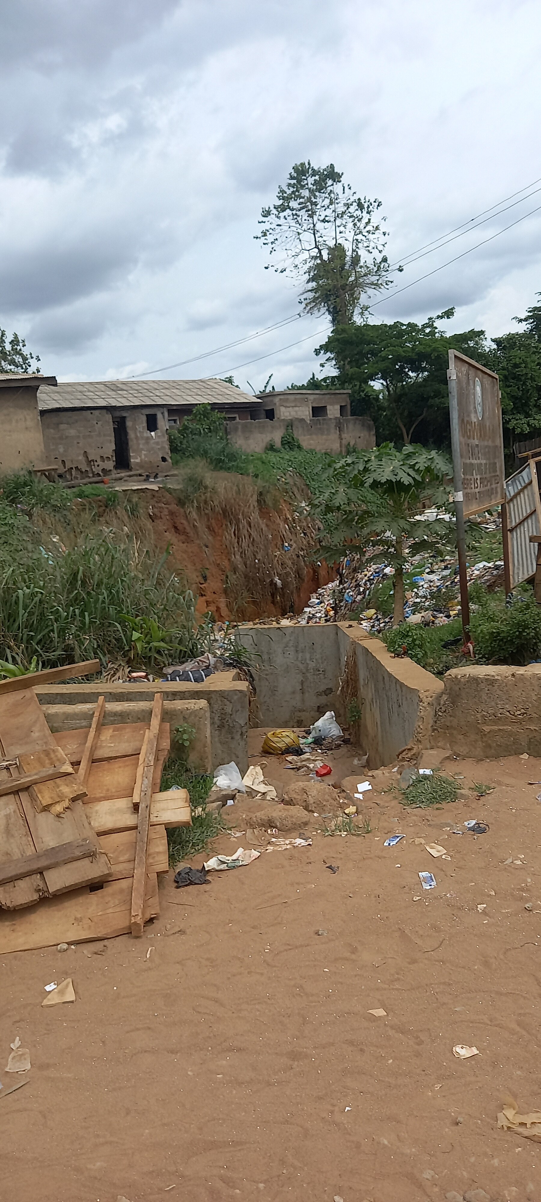
An image of a deep pit caused by erosion.
Summary
edit
| Description |
English: An image of a deep pit caused by erosion, at Ọtun Ota, Ogun State. This pit was named from the name of the area located "koto ọ̀tún" "kòrọ́ọ̀tún".
Yorùbá: Àwòrán kòtò kan tí àgbàrá dá sílẹ̀, Ọ̀tún Ota, ní ìpínlẹ̀ Ogun. Wọ́n fún kòtò yìí lórúkọ látàrí agbègbè tí kòtò náà wá "kòtò ọ̀tún" "kòrọ́ọ̀tún".
Igbo: Ihe onyonyo nke olulu miri emi nke mbuze butere, na Ọtun Ota, Ogun State. Aha olulu a sitere n'aha ebe ahụ dị "koto ọ̀tún" "kòrọ́ọ̀tún". |
| Date | |
| Source | Own work |
| Author | Enitanade |
Licensing
edit
I, the copyright holder of this work, hereby publish it under the following license:
This file is licensed under the Creative Commons Attribution-Share Alike 4.0 International license.
- You are free:
- to share – to copy, distribute and transmit the work
- to remix – to adapt the work
- Under the following conditions:
- attribution – You must give appropriate credit, provide a link to the license, and indicate if changes were made. You may do so in any reasonable manner, but not in any way that suggests the licensor endorses you or your use.
- share alike – If you remix, transform, or build upon the material, you must distribute your contributions under the same or compatible license as the original.

|
This image was uploaded as part of Wiki Loves Africa 2023 in South West of Nigeria organized by Yoruba Wikimedians User Group.
|
|
|
This image was uploaded as part of Wiki Loves Africa 2023 photographic contest.
|
File history
Click on a date/time to view the file as it appeared at that time.
| Date/Time | Thumbnail | Dimensions | User | Comment | |
|---|---|---|---|---|---|
| current | 17:33, 29 March 2023 | | 1,800 × 4,000 (2.71 MB) | Enitanade (talk | contribs) | Uploaded own work with UploadWizard |
You cannot overwrite this file.
File usage on Commons
There are no pages that use this file.