File:K-219 Karte.jpg

Size of this preview: 564 × 600 pixels. Other resolutions: 226 × 240 pixels | 451 × 480 pixels | 759 × 807 pixels.
Original file (759 × 807 pixels, file size: 23 KB, MIME type: image/jpeg)
Captions
Captions
Add a one-line explanation of what this file represents
Summary edit
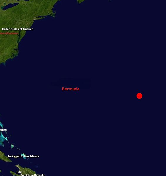
Map of place where submarine K-219 sunk. Image: NASA World Wind
Licensing edit
| This image is in the public domain because it is a screenshot from NASA’s globe software World Wind using a public domain layer, such as Blue Marble, MODIS, Landsat, SRTM, USGS or GLOBE.
|
 |
File history
Click on a date/time to view the file as it appeared at that time.
| Date/Time | Thumbnail | Dimensions | User | Comment | |
|---|---|---|---|---|---|
| current | 11:34, 2 December 2005 | | 759 × 807 (23 KB) | Schlendrian (talk | contribs) | Map of place where K-219 sunk |
You cannot overwrite this file.
File usage on Commons
The following page uses this file:
File usage on other wikis
The following other wikis use this file:
- Usage on de.wikipedia.org
- Usage on fr.wikipedia.org
- Usage on it.wikipedia.org
- Usage on ja.wikipedia.org
- Usage on ru.wikipedia.org