File:KG-Ysyk-Kol-Tup.svg

Size of this PNG preview of this SVG file: 771 × 214 pixels. Other resolutions: 320 × 89 pixels | 640 × 178 pixels | 1,024 × 284 pixels | 1,280 × 355 pixels | 2,560 × 711 pixels.
Original file (SVG file, nominally 771 × 214 pixels, file size: 1.57 MB)
Captions
Captions
KG-Ysyk-Kol-Tup
Summary edit
| Description |
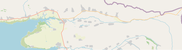
English: KG-Ysyk-Kol-Tup |
| Date | |
| Source | openstreetmap.org |
| Author | OpenStreetMap contributors |
Licensing edit
| Description |
This map was created from OpenStreetMap project data, collected by the community. This map may be incomplete, and may contain errors. Don't rely solely on it for navigation. |
|||
| Date | (see file history) | |||
| Source | openstreetmap.org | |||
| Creator |
OpenStreetMap contributors |
|||
| Permission (Reusing this file) |
OpenStreetMap data is available under the Open Database License (details). Map tiles are licensed under the Creative Commons Attribution-ShareAlike 2.0 license (CC-BY-SA 2.0).
This file is licensed under the Creative Commons Attribution-Share Alike 2.0 Generic license.
|
|||
| Georeferencing | If inappropriate please set warp_status = skip to hide. |
File history
Click on a date/time to view the file as it appeared at that time.
| Date/Time | Thumbnail | Dimensions | User | Comment | |
|---|---|---|---|---|---|
| current | 21:12, 13 November 2021 | 771 × 214 (1.57 MB) | Kmaksat (talk | contribs) | Kichi-Oruktu village was included. | |
| 10:56, 9 November 2021 | 758 × 223 (1.73 MB) | Kmaksat (talk | contribs) | Uploaded a work by OpenStreetMap contributors from openstreetmap.org with UploadWizard |
You cannot overwrite this file.
File usage on Commons
There are no pages that use this file.
File usage on other wikis
The following other wikis use this file:
- Usage on en.wikipedia.org
- Usage on ky.wikipedia.org
- Usage on ru.wikipedia.org
- Тюпский район
- Тюп
- Ак-Булак (Тюпский район)
- Сары-Дёбё
- Кош-Дёбё (Иссык-Кульская область)
- Долон (село)
- Арал (Иссык-Кульская область)
- Мин-Булак (Иссык-Кульская область)
- Ынтымак (Иссык-Кульская область)
- Ак-Булун (Тюпский район)
- Иссык-Кёль (Тюпский район)
- Кутургу
- Кичи-Орюкту
- Ой-Булак
- Ой-Тал (Иссык-Кульская область)
- Михайловка (Иссык-Кульская область)
- Тогуз-Булак (Тюпский район)
- Сары-Булун (Иссык-Кульская область)
- Каркыра (село)
- Кен-Суу (Тюпский район)
- Сан-Таш
- Сары-Телегей
- Байзак (Иссык-Кульская область)
- Балбай
- Кюрментю
- Беловодское (Иссык-Кульская область)
- Фрунзенское (Иссык-Кульская область)
- Ичке-Суу (Иссык-Кульская область)
- Кёочу
- Корумду (Тюпский район)
- Талды-Суу (Иссык-Кульская область)
- Тасма (село)
- Чон-Тогуз-Бай
- Токтоян
- Бирлик (Иссык-Кульская область)
- Шаты
- Джылуу-Булак
- Чон-Таш
- Шаблон:ПозКарта Кыргызстан Иссык-Кульская область Тюпский район
- Usage on si.wikipedia.org