File:KT612YZ-C2-222.jpg

Size of this preview: 593 × 599 pixels. Other resolutions: 237 × 240 pixels | 475 × 480 pixels | 760 × 768 pixels | 1,013 × 1,024 pixels | 2,026 × 2,048 pixels | 3,337 × 3,373 pixels.
Original file (3,337 × 3,373 pixels, file size: 3.8 MB, MIME type: image/jpeg)
Captions
Captions
Add a one-line explanation of what this file represents
| Description |
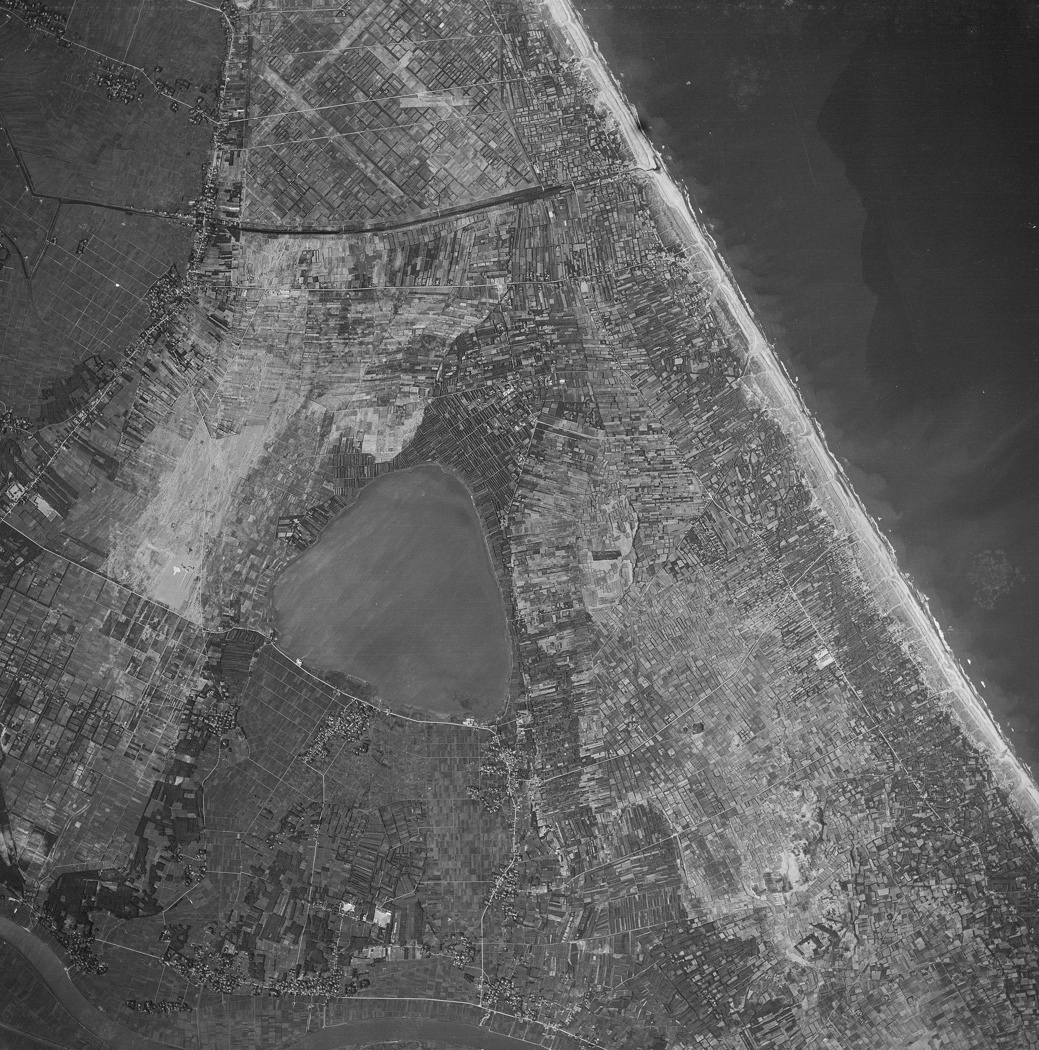
日本語: 1961年に撮影された神之池周辺 English: Around Gō-no-ike pond taken in 1961 |
||
| Date | |||
| Source |
English: Aerial photo numbered Reference number: KT612YZ, cource number: C2, photo number: 222 on map & aerial photo browsing service 日本語: 地図・空中写真閲覧サービス上の整理番号: KT612YZ・コース番号: C2・写真番号: 222の空中写真 |
||
| Author |
日本語: 国土地理院 |
||
| Permission (Reusing this file) |
This file is licensed under the Creative Commons Attribution 4.0 International license.
|

File history
Click on a date/time to view the file as it appeared at that time.
| Date/Time | Thumbnail | Dimensions | User | Comment | |
|---|---|---|---|---|---|
| current | 14:21, 6 August 2016 | | 3,337 × 3,373 (3.8 MB) | 軽快 (talk | contribs) | {{Information |Description={{ja|1961年に撮影されたja:神之池周辺}}<br>{{en|Around Gō-no-ike pond taken in 1961}} |Source={{en|Aerial photo numbered Reference number: KT612YZ, cource number: C2, photo number: 222 on [[http://mapps.gsi.... |
You cannot overwrite this file.
File usage on Commons
There are no pages that use this file.
File usage on other wikis
The following other wikis use this file:
- Usage on ja.wikipedia.org