File:Kaart Den Hoorn1712.jpg

Size of this preview: 786 × 600 pixels. Other resolutions: 315 × 240 pixels | 629 × 480 pixels | 1,007 × 768 pixels | 1,279 × 976 pixels.
Original file (1,279 × 976 pixels, file size: 372 KB, MIME type: image/jpeg)
Captions
Captions
Add a one-line explanation of what this file represents
Summary edit
| Description |
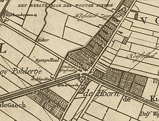
Nederlands: Kaart van het hoogheemraadschap van Delfland, gemeten door de landmeters Nicolaas en Joacobus Kruchius. Afgebeeld is Den Hoorn, Zuid-Holland. |
| Date | |
| Source | http://beeldbank.nationaalarchief.nl/na:col1:dat512859 |
| Author | Nicolaas en Joacobus Kruchius |
Licensing edit
|
This work is in the public domain in its country of origin and other countries and areas where the copyright term is the author's life plus 100 years or fewer. | |
| This file has been identified as being free of known restrictions under copyright law, including all related and neighboring rights. | |
File history
Click on a date/time to view the file as it appeared at that time.
| Date/Time | Thumbnail | Dimensions | User | Comment | |
|---|---|---|---|---|---|
| current | 15:58, 20 April 2009 | | 1,279 × 976 (372 KB) | Druifkes (talk | contribs) | {{Information |Description={{nl|1=Kaart van het hoogheemraadschap van Delfland, gemeten door de landmeters Nicolaas en Joacobus Kruchius. Afgebeeld is Den Hoorn, Zuid-Holland.}} |Source=http://beeldbank.nationaalarchief.nl/na:col1:dat512859 |Author=Nicola |
You cannot overwrite this file.
File usage on Commons
There are no pages that use this file.
File usage on other wikis
The following other wikis use this file:
- Usage on nl.wikipedia.org