File:Kagiken-baizankyou.svg

Size of this PNG preview of this SVG file: 646 × 341 pixels. Other resolutions: 320 × 169 pixels | 640 × 338 pixels | 1,024 × 541 pixels | 1,280 × 676 pixels | 2,560 × 1,351 pixels.
Original file (SVG file, nominally 646 × 341 pixels, file size: 428 KB)
Captions
Captions
Add a one-line explanation of what this file represents
Summary edit
| Description |
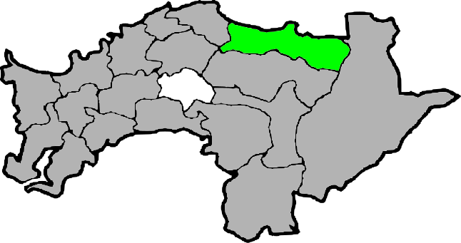
日本語: 嘉義縣梅山郷の位置 |
| Date | |
| Source | 自作 |
| Author | Hakatanoshio117117 |
Licensing edit
| I, the copyright holder of this work, release this work into the public domain. This applies worldwide. In some countries this may not be legally possible; if so: I grant anyone the right to use this work for any purpose, without any conditions, unless such conditions are required by law. |
File history
Click on a date/time to view the file as it appeared at that time.
| Date/Time | Thumbnail | Dimensions | User | Comment | |
|---|---|---|---|---|---|
| current | 04:20, 25 October 2009 | | 646 × 341 (428 KB) | Hakatanoshio117117 (talk | contribs) | {{Information |Description={{ja|1=嘉義縣梅山郷の位置}} |Source=自作 |Author=Hakatanoshio117117 |Date=2009.10.25 |Permission= |other_versions= }} Category:Maps of Taipei |
You cannot overwrite this file.
File usage on Commons
There are no pages that use this file.
File usage on other wikis
The following other wikis use this file:
- Usage on ja.wikipedia.org
- Usage on zh.wikipedia.org