File:Kaluga map 1919.gif

Size of this preview: 494 × 600 pixels. Other resolutions: 198 × 240 pixels | 395 × 480 pixels | 632 × 768 pixels | 843 × 1,024 pixels | 1,687 × 2,048 pixels | 6,410 × 7,783 pixels.
Original file (6,410 × 7,783 pixels, file size: 11.06 MB, MIME type: image/gif)
Captions
Captions
Add a one-line explanation of what this file represents
Summary edit
| Description |
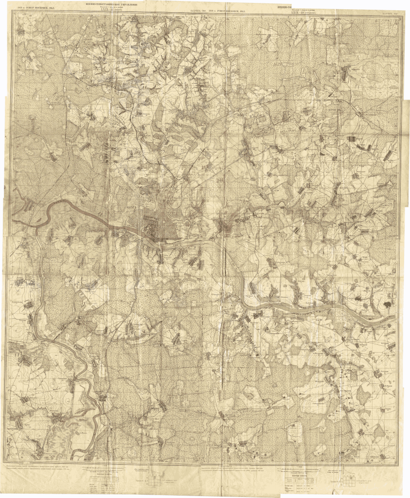
Русский: Карта города Калуги и окрестностей English: Map city of Kaluga and its environs |
| Date | |
| Source | http://www.retromap.ru/forum/viewtopic.php?t=3684 |
| Creator |
Unknown author |
| Permission (Reusing this file) |
Русский: Военно-топографическое управление РСФСР English: Military topographic administration of the RSFSR |
| Georeferencing | If inappropriate please set warp_status = skip to hide. |
Карта Калуги и окрестностей. Лист LXIX-48 (Калуга). 1919г. РСФСР. Московск. обл. Калужский окр. Военно-топографическое Управление. Масштаб - 1 верста в дюйме.
Licensing edit
|
This work is in the public domain in its country of origin and other countries and areas where the copyright term is the author's life plus 100 years or fewer. This work is in the public domain in the United States because it was published (or registered with the U.S. Copyright Office) before January 1, 1929. | |
| This file has been identified as being free of known restrictions under copyright law, including all related and neighboring rights. | |
File history
Click on a date/time to view the file as it appeared at that time.
| Date/Time | Thumbnail | Dimensions | User | Comment | |
|---|---|---|---|---|---|
| current | 06:50, 9 September 2017 | | 6,410 × 7,783 (11.06 MB) | Frutti-mytti (talk | contribs) | {{Information |Description={{ru|1=Карта города Калуги и окрестностей}}{{en|1=Map city of Kaluga and its environs}} |Source=Калужский областной краеведческий музей |Date= 1919 |Author= {{... |
You cannot overwrite this file.
File usage on Commons
There are no pages that use this file.
File usage on other wikis
The following other wikis use this file:
- Usage on ru.wikipedia.org