File:Kamishiro fault earthquake 1.jpg
Size of this preview: 800 × 600 pixels. Other resolutions: 320 × 240 pixels | 640 × 480 pixels | 1,024 × 768 pixels | 1,280 × 960 pixels | 2,560 × 1,920 pixels | 4,608 × 3,456 pixels.
Original file (4,608 × 3,456 pixels, file size: 6.01 MB, MIME type: image/jpeg)
Captions
Captions
Add a one-line explanation of what this file represents
Summary edit
| Description |
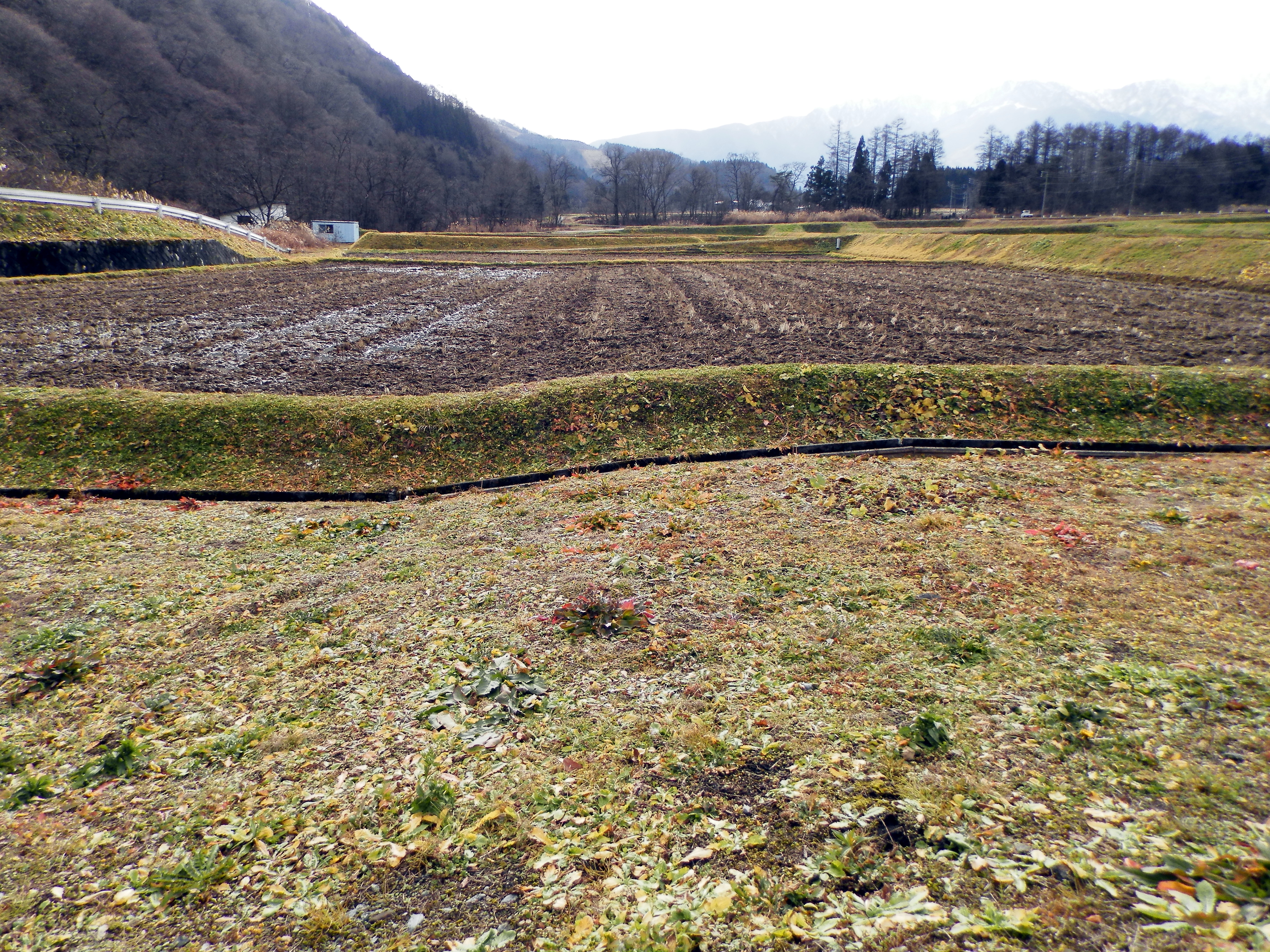
日本語: 長野県神城断層地震(2014)により水田に生じたバックトラストによる撓曲地表変位。南を向いて撮影。白馬村北城地区。
English: The surface displacement which has occurred to a rice paddy by Nagano-ken Kamishiro fault earthquake. |
| Date | |
| Source | Own work |
| Author | Apple2000 |
| Other versions | 産業技術総合研究所による第三報地表地震断層緊急調査報告(2) [2014年12月9日] 2014年11月22日長野県北部の地震 の写真9 は、同じ場所を撮影。 |
| Camera location | | View this and other nearby images on: OpenStreetMap |
|---|
Licensing edit
I, the copyright holder of this work, hereby publish it under the following license:
| This file is made available under the Creative Commons CC0 1.0 Universal Public Domain Dedication. | |
| The person who associated a work with this deed has dedicated the work to the public domain by waiving all of their rights to the work worldwide under copyright law, including all related and neighboring rights, to the extent allowed by law. You can copy, modify, distribute and perform the work, even for commercial purposes, all without asking permission.
|
File history
Click on a date/time to view the file as it appeared at that time.
| Date/Time | Thumbnail | Dimensions | User | Comment | |
|---|---|---|---|---|---|
| current | 01:27, 1 December 2014 | | 4,608 × 3,456 (6.01 MB) | Apple2000 (talk | contribs) | User created page with UploadWizard |
You cannot overwrite this file.
File usage on Commons
The following page uses this file:
File usage on other wikis
The following other wikis use this file:
- Usage on en.wikipedia.org
- Usage on ja.wikipedia.org