File:Kammmolchmaennchen.jpg
Size of this preview: 800 × 512 pixels. Other resolutions: 320 × 205 pixels | 640 × 410 pixels | 1,024 × 655 pixels | 1,517 × 971 pixels.
Original file (1,517 × 971 pixels, file size: 1.15 MB, MIME type: image/jpeg)
Captions
Captions
Add a one-line explanation of what this file represents
Summary edit
| Description |
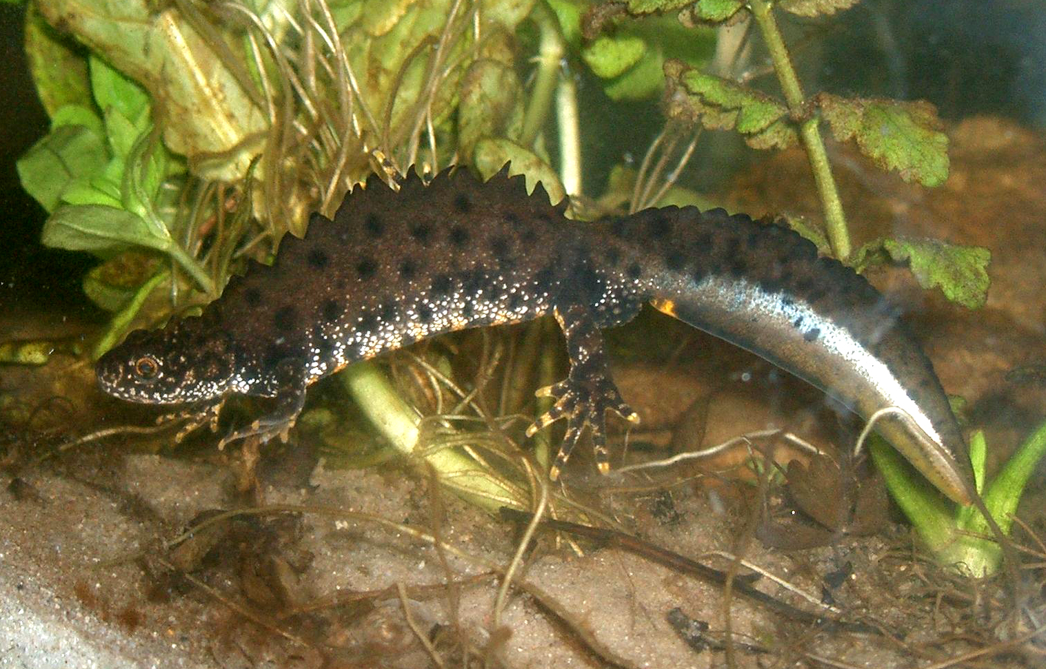
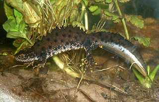
English: The Crested Newt (Triturus cristatus); male specimen in "mating dress" under water.
Deutsch: Der Kammmolch (Triturus cristatus); hier ein Männchen in Wassertracht in einem Aquarium. |
| Date | |
| Source | originally uploaded on de.wikipedia.org (file: [1]). |
| Author | Rainer Theuer. |
![[1]](https://de.wikipedia.org/wiki/Bild:Kammolchmaennchen.JPG)
Licensing edit
| I, the copyright holder of this work, release this work into the public domain. This applies worldwide. In some countries this may not be legally possible; if so: I grant anyone the right to use this work for any purpose, without any conditions, unless such conditions are required by law. |
File history
Click on a date/time to view the file as it appeared at that time.
| Date/Time | Thumbnail | Dimensions | User | Comment | |
|---|---|---|---|---|---|
| current | 16:29, 23 August 2008 | | 1,517 × 971 (1.15 MB) | Fice (talk | contribs) | {{Information| |Description='''''English''''': The '''Crested Newt''' (''Triturus cristatus''); male specimen in "mating dress" under water. '''''Deutsch''''': Der '''Kammmolch''' (''Triturus cristatus''); hier ein Männ |
You cannot overwrite this file.
File usage on Commons
The following 5 pages use this file:
File usage on other wikis
The following other wikis use this file:
- Usage on an.wikipedia.org
- Usage on arz.wikipedia.org
- Usage on az.wikipedia.org
- Usage on ba.wikipedia.org
- Usage on be.wikipedia.org
- Usage on bg.wikipedia.org
- Usage on br.wikipedia.org
- Usage on ca.wikipedia.org
- Usage on ceb.wikipedia.org
- Usage on cs.wikipedia.org
- Usage on cy.wikipedia.org
- Usage on de.wikipedia.org
- Bundesautobahn 44
- Nördlicher Kammmolch
- Schwanzlurche
- Nemphe
- Fließwiese Ruhleben
- Untere Argen und Seitentäler
- Rotachtal Bodensee
- Bodenseehinterland zwischen Salem und Markdorf
- Bodensee Hinterland bei Überlingen
- Feuchtgebiete um Bad Schussenried
- Feuchtgebiete um Altshausen
- Wurzacher Ried und Rohrsee
- Riede und Gewässer bei Mengen und Pfullendorf
- Gebiete um das Laucherttal
- Naturschutzgebiet Unteres Morsbachtal mit Hölterfelder Siefen und Fürberger Bachtal
- Neckar und Seitentäler bei Rottenburg
- Umlachtal und Riß südlich Biberach
- Wälder bei Biberach
- Donau zwischen Munderkingen und Ulm und nördliche Iller
- Donau zwischen Munderkingen und Riedlingen
- Donaumoos (FFH-Gebiet)
- Großer Heuberg und Donautal
- Kuppenalb bei Laichingen und Lonetal
- Schönbuch (FFH-Gebiet)
- Argen und Feuchtgebiete bei Neukirch und Langnau
- Albtrauf zwischen Mössingen und Gönningen
- Baar, Eschach und Südostschwarzwald
- Südliche Baaralb
View more global usage of this file.