File:Kampinos (gmina) location map.png

Size of this preview: 686 × 600 pixels. Other resolutions: 275 × 240 pixels | 549 × 480 pixels | 819 × 716 pixels.
Original file (819 × 716 pixels, file size: 85 KB, MIME type: image/png)
Captions
Captions
Add a one-line explanation of what this file represents
| Description |
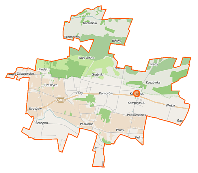
Polski: Mapa gminy Kampinos, Polska
English: Map of Gmina Kampinos, Poland |
|||||||||
| Date | ||||||||||
| Source | You may find a page on the OpenStreetMap wiki page for Kampinos (gmina) | |||||||||
| Creator |
OpenStreetMap contributors OpenStreetMap contributors |
|||||||||
| Permission (Reusing this file) |
OpenStreetMap data is available under the Open Database License (details). Map tiles are licensed under the Creative Commons Attribution-ShareAlike 2.0 license (CC-BY-SA 2.0).
This file is licensed under the Creative Commons Attribution-Share Alike 2.0 Generic license.
|
|||||||||
| Geotemporal data | ||||||||||
| Bounding box |
|
|||||||||
| Georeferencing | If inappropriate please set warp_status = skip to hide. | |||||||||
File history
Click on a date/time to view the file as it appeared at that time.
| Date/Time | Thumbnail | Dimensions | User | Comment | |
|---|---|---|---|---|---|
| current | 16:38, 9 October 2014 | | 819 × 716 (85 KB) | VanWiel (talk | contribs) | {{OpenStreetMap | name = Kampinos (gmina) | location = Kampinos (gmina) | description = {{pl|Mapa gminy Kampinos, Polska}} {{en|Map of Gmina Kampinos, Poland}} | top = 52.3351 | left = 20.3065 | r... |
You cannot overwrite this file.
File usage on Commons
There are no pages that use this file.
File usage on other wikis
The following other wikis use this file:
- Usage on fr.wikipedia.org
- Usage on pl.wikipedia.org
- Kampinos
- Kampinos (gmina)
- Kampinos A
- Kirsztajnów
- Pasikonie
- Podkampinos
- Skarbikowo
- Stare Gnatowice
- Wiejca
- Wola Pasikońska
- Kwiatkówek (województwo mazowieckie)
- Strojec (województwo mazowieckie)
- Strzyżew (województwo mazowieckie)
- Bieliny (powiat warszawski zachodni)
- Bromierzyk (powiat warszawski zachodni)
- Grabnik (powiat warszawski zachodni)
- Komorów (powiat warszawski zachodni)
- Łazy (powiat warszawski zachodni)
- Prusy (powiat warszawski zachodni)
- Szczytno (powiat warszawski zachodni)
- Zawady (powiat warszawski zachodni)
- Józefów (gmina Kampinos)
- Granica (powiat warszawski zachodni)
- Pindal (województwo mazowieckie)
- Budki Żelazowskie
- Rzęszyce
- Łazy Leśne
- Koszówka
- Parafia Wniebowzięcia Najświętszej Maryi Panny w Kampinosie
- Cmentarz wojskowy w Granicy
- Karolinów (powiat warszawski zachodni)
- Ludwików (powiat warszawski zachodni)
- Kościół Wniebowzięcia Najświętszej Maryi Panny w Kampinosie
- Moduł:Mapa/dane/Kampinos (gmina)
- Parafia św. Doroty w Zawadach
- Obszar ochrony ścisłej Pożary
- Obszar ochrony ścisłej Przyćmień
- Dąb Stefan (Kampinos)
- Dąb Powstańców
- Dwór w Strzyżewie
- Usage on pl.wikibooks.org
_location_map.png&oldid=519969069)