File:Karimunjawa 2019-09-13 Landsat 8 T1 TOA.jpeg
Size of this preview: 799 × 374 pixels. Other resolutions: 320 × 150 pixels | 640 × 300 pixels | 1,024 × 479 pixels | 1,280 × 599 pixels | 2,256 × 1,056 pixels.
Original file (2,256 × 1,056 pixels, file size: 107 KB, MIME type: image/jpeg)
Captions
Captions
Add a one-line explanation of what this file represents
Summary edit
| Description |
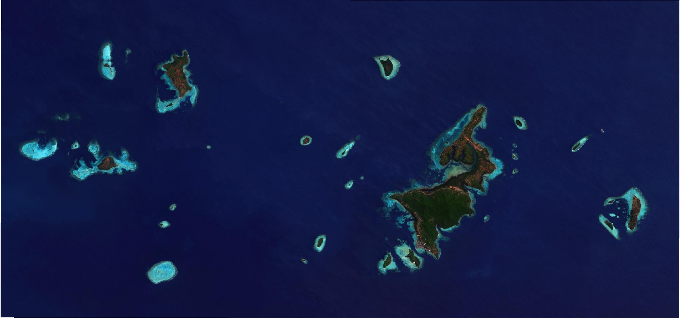
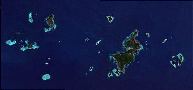
Bahasa Indonesia: Citra top-of-atmosphere Kepulauan Karimunjawa dari satelit Landsat 8 tanggal 2019-09-13. Kecerahan dan saturasi gambar telah diproses menggunakan QGIS.
English: Landsat 8 top-of-atmosphere image of Karimunjawa Islands on 2019-09-13. Brightnes and saturation was enhanced using QGIS. |
|||||||||
| Date | ||||||||||
| Source | Contains modified data from Landsat 8. | |||||||||
| Creator |
USGS/NASA Landsat Program, RXerself |
|||||||||
| Geotemporal data | ||||||||||
| Bounding box |
|
|||||||||
Licensing edit
This file is licensed under the Creative Commons Attribution-Share Alike 4.0 International license.
- You are free:
- to share – to copy, distribute and transmit the work
- to remix – to adapt the work
- Under the following conditions:
- attribution – You must give appropriate credit, provide a link to the license, and indicate if changes were made. You may do so in any reasonable manner, but not in any way that suggests the licensor endorses you or your use.
- share alike – If you remix, transform, or build upon the material, you must distribute your contributions under the same or compatible license as the original.
| Annotations | This image is annotated: View the annotations at Commons |
File history
Click on a date/time to view the file as it appeared at that time.
| Date/Time | Thumbnail | Dimensions | User | Comment | |
|---|---|---|---|---|---|
| current | 19:40, 14 October 2019 | | 2,256 × 1,056 (107 KB) | RXerself (talk | contribs) | {{Information |description ={{id|1=Citra top-of-atmosphere Kepulauan Karimunjawa dari satelit Landsat 8 tanggal 2019-09-13. Kecerahan dan saturasi gambar telah diproses menggunakan QGIS.}} {{en|1=Landsat 8 top-of-atmosphere image of Karimunjawa Islands on 2019-09-13. Brightnes and saturation was enhanced using QGIS.}} |date =2019-09-13 |source =Contains modified public domain data from Landsat 8. }} Category:Karimunjawa [[Category:Satellite... |
You cannot overwrite this file.
File usage on Commons
The following 3 pages use this file:
File usage on other wikis
The following other wikis use this file:
- Usage on ar.wikipedia.org
- Usage on ca.wikipedia.org
- Usage on de.wikipedia.org
- Usage on en.wikipedia.org
- Usage on en.wikivoyage.org
- Usage on es.wikipedia.org
- Usage on fr.wikivoyage.org
- Usage on id.wikipedia.org
- Usage on it.wikivoyage.org
- Usage on www.wikidata.org