File:Karrendorfer Wiesen und NSG Insel Koos, Kooser See und Wampener Riff 03.jpg
Size of this preview: 800 × 450 pixels. Other resolutions: 320 × 180 pixels | 640 × 360 pixels | 1,024 × 576 pixels | 1,280 × 720 pixels | 2,560 × 1,440 pixels | 4,978 × 2,800 pixels.
Original file (4,978 × 2,800 pixels, file size: 4.57 MB, MIME type: image/jpeg)
Captions
Captions
Add a one-line explanation of what this file represents
Summary
edit
| Description |
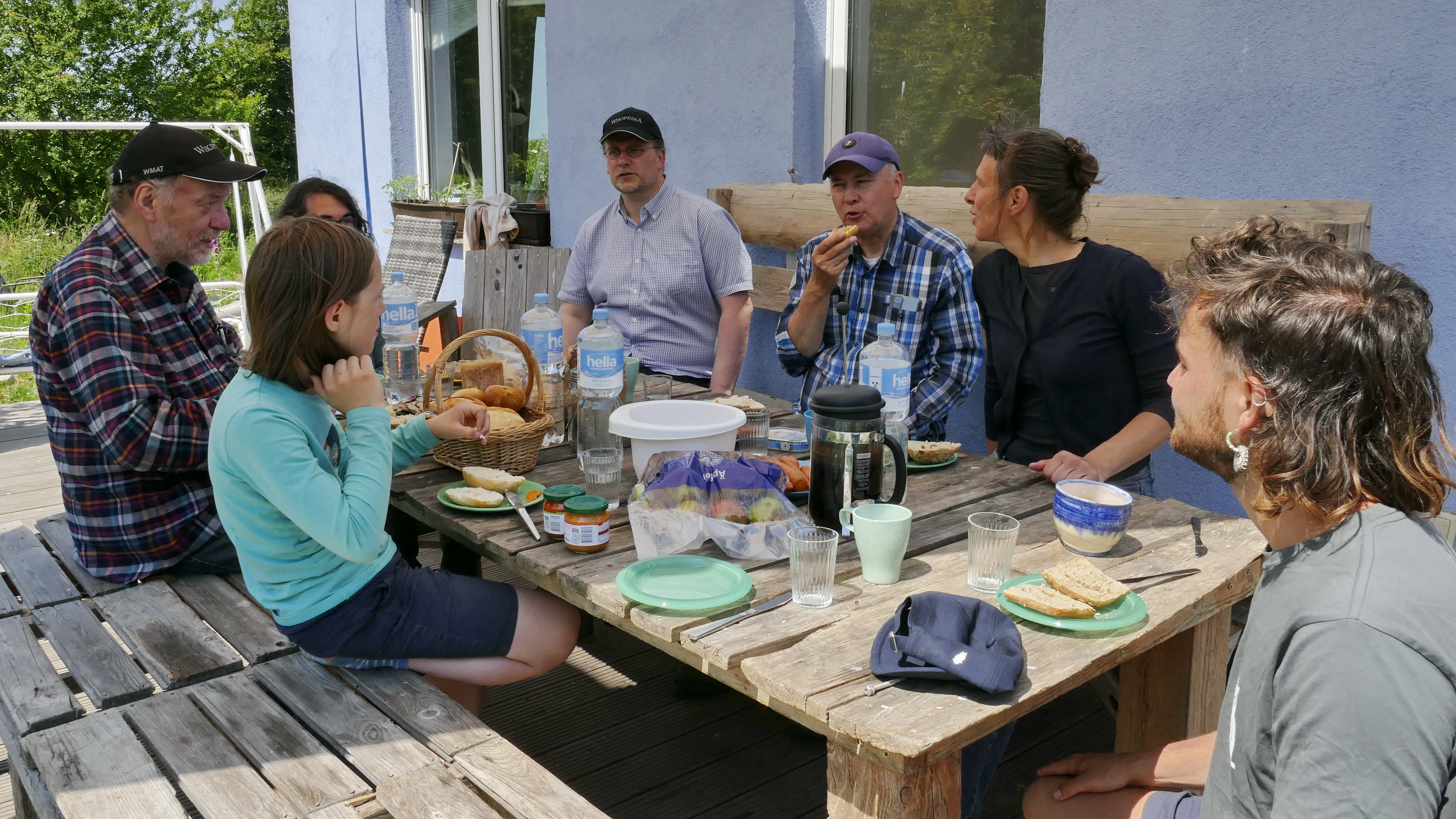
Deutsch: Ferdinand Reihlen-Börgers informiert eine Gruppe von Wikipedianern über die Karrendorfer Wiesen (im Hintergrund) und das Naturschutzgebiet "Insel Koos, Kooser See und Wampener Riff". Als von der Michael Succow Stiftung angestellter Naturschutzwart arbeitet er 2023 zusammen mit einer weiteren Bundesfreiwilligen im Naturschutzgebiet. Hier ist ein Arbeitsessen der Gruppe auf der Insel Koos zu sehen. |
| Date | |
| Source | Own work |
| Author | Puusterke |
| Camera location | | View this and other nearby images on: OpenStreetMap |
|---|
Licensing
edit
I, the copyright holder of this work, hereby publish it under the following license:
This file is licensed under the Creative Commons Attribution-Share Alike 4.0 International license.
- You are free:
- to share – to copy, distribute and transmit the work
- to remix – to adapt the work
- Under the following conditions:
- attribution – You must give appropriate credit, provide a link to the license, and indicate if changes were made. You may do so in any reasonable manner, but not in any way that suggests the licensor endorses you or your use.
- share alike – If you remix, transform, or build upon the material, you must distribute your contributions under the same or compatible license as the original.
File history
Click on a date/time to view the file as it appeared at that time.
| Date/Time | Thumbnail | Dimensions | User | Comment | |
|---|---|---|---|---|---|
| current | 19:32, 16 June 2023 | | 4,978 × 2,800 (4.57 MB) | Puusterke (talk | contribs) | Uploaded own work with UploadWizard |
You cannot overwrite this file.
File usage on Commons
There are no pages that use this file.