File:Karta Delagardi.gif
Size of this preview: 800 × 534 pixels. Other resolutions: 320 × 213 pixels | 640 × 427 pixels | 817 × 545 pixels.
Original file (817 × 545 pixels, file size: 333 KB, MIME type: image/gif)
Captions
Captions
Add a one-line explanation of what this file represents
Summary
edit
| Description |
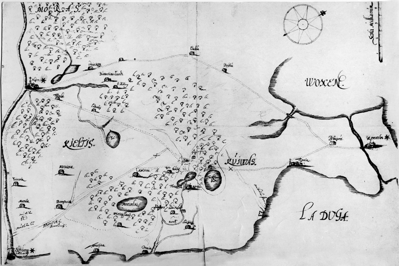
English: Map of Ingria and Karelia at 1580 year
Русский: Карта Корельского и части Ореховского уездов, составленная, предположительно, в 1580 году по приказу Понтуса Делагарди. |
| Date | between 1580 and 1582 |
| Source | http://gorchev.lib.ru/ik/Predystoriya%20SPb_1703god/B1_Razdel_1/1_1_22.html |
| Author | Unknown author |
Licensing
edit
|
This work is in the public domain in its country of origin and other countries and areas where the copyright term is the author's life plus 100 years or fewer. | |
| This file has been identified as being free of known restrictions under copyright law, including all related and neighboring rights. | |
File history
Click on a date/time to view the file as it appeared at that time.
| Date/Time | Thumbnail | Dimensions | User | Comment | |
|---|---|---|---|---|---|
| current | 22:29, 25 February 2009 | | 817 × 545 (333 KB) | Ukko~commonswiki (talk | contribs) | {{Information |Description={{en|1=Map of Ingria and Karelia at 1580 year}} {{ru|1=Карта Корельского и части Ореховского уездов, состав |
You cannot overwrite this file.
File usage on Commons
There are no pages that use this file.
File usage on other wikis
The following other wikis use this file:
- Usage on ru.wikipedia.org
- Usage on uk.wikipedia.org