File:Karte - Englisch-Spanischer Krieg in der Karibik 1726-1728.png
Size of this preview: 768 × 600 pixels. Other resolutions: 307 × 240 pixels | 615 × 480 pixels | 983 × 768 pixels | 1,188 × 928 pixels.
Original file (1,188 × 928 pixels, file size: 172 KB, MIME type: image/png)
Captions
Captions
Add a one-line explanation of what this file represents
Summary
edit
| Description |
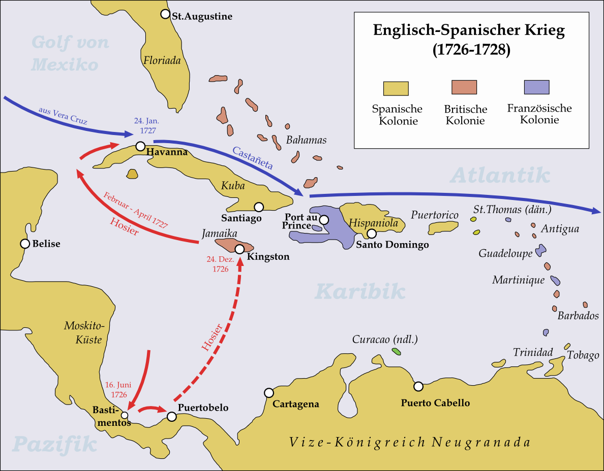
English: Map showing the operations in the Caribbean during the Anglo-Spanish War 1726-28. |
| Date | |
| Source | Own work |
| Author | Memnon335bc |
Licensing
edit
I, the copyright holder of this work, hereby publish it under the following license:
This file is licensed under the Creative Commons Attribution 3.0 Unported license.
- You are free:
- to share – to copy, distribute and transmit the work
- to remix – to adapt the work
- Under the following conditions:
- attribution – You must give appropriate credit, provide a link to the license, and indicate if changes were made. You may do so in any reasonable manner, but not in any way that suggests the licensor endorses you or your use.
File history
Click on a date/time to view the file as it appeared at that time.
| Date/Time | Thumbnail | Dimensions | User | Comment | |
|---|---|---|---|---|---|
| current | 21:46, 31 May 2015 | | 1,188 × 928 (172 KB) | Cmdrjameson (talk | contribs) | Compressed with pngout. Reduced by 94kB (35% decrease). |
| 21:24, 22 March 2011 |  | 1,188 × 928 (267 KB) | Memnon335bc (talk | contribs) | {{Information |Description ={{en|1=Map showing the operations in the Caribbean during the Anglo-Spanish War 1726-28.}} |Source ={{own}} |Author =Memnon335bc |Date =2011-03 |Permission = |other_versions |
You cannot overwrite this file.
File usage on Commons
The following page uses this file:
File usage on other wikis
The following other wikis use this file:
- Usage on de.wikipedia.org
- Usage on fr.wikipedia.org
- Usage on ja.wikipedia.org