File:Karte Aut Stmk BM (bis 2012).png
(Redirected from File:Karte Aut Stmk Bruck an der Mur.png)
No higher resolution available.
Karte_Aut_Stmk_BM_(bis_2012).png (300 × 209 pixels, file size: 5 KB, MIME type: image/png)
Captions
Captions
Add a one-line explanation of what this file represents
Summary
edit.png&action=edit§ion=1)
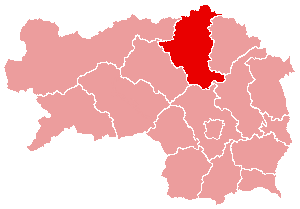
- English: Political map of the district Bruck an der Mur, Styria, Austria (until 2012)
- Deutsch: Politische Karte vom Bezirk Bruck an der Mur (bis 2012)
- drawing by de:User:plp from 2004
- Source: de.wikipedia.org: 22:37, 5. Apr 2004 . . Plp (Diskussion) . . 300 x 209 (3933 Byte)
Licensing
edit.png&action=edit§ion=2)

|
Permission is granted to copy, distribute and/or modify this document under the terms of the GNU Free Documentation License, Version 1.2 or any later version published by the Free Software Foundation; with no Invariant Sections, no Front-Cover Texts, and no Back-Cover Texts. A copy of the license is included in the section entitled GNU Free Documentation License. |
| This file is licensed under the Creative Commons Attribution-Share Alike 3.0 Unported license. | ||
| ||
| This licensing tag was added to this file as part of the GFDL licensing update. |
File history
Click on a date/time to view the file as it appeared at that time.
| Date/Time | Thumbnail | Dimensions | User | Comment | |
|---|---|---|---|---|---|
| current | 12:22, 10 January 2015 | | 300 × 209 (5 KB) | Kontrollstellekundl (talk | contribs) | Reverted to version as of 13:29, 24 March 2012 |
| 18:58, 4 January 2015 |  | 1,000 × 700 (98 KB) | Kontrollstellekundl (talk | contribs) | Grenzen aller Bezirke ab 2015, Datei wird bei Imagemaps verwendet, deshalb für den "alten" Bezirk BM nicht mehr richtig! | |
| 20:41, 6 January 2013 |  | 300 × 209 (5 KB) | Kontrollstellekundl (talk | contribs) | Reverted to version as of 13:29, 24 March 2012 | |
| 17:54, 1 January 2013 |  | 300 × 209 (3 KB) | Gugganij (talk | contribs) | Merger of two districts to Bruck-Mürzzuschlag (BM) | |
| 13:29, 24 March 2012 |  | 300 × 209 (5 KB) | Kontrollstellekundl (talk | contribs) | JU + KF = MT, 01.01.2012 | |
| 01:42, 16 March 2006 |  | 300 × 209 (4 KB) | Inge-Lyubov~commonswiki (talk | contribs) | *{{en|Political map of the Bruck an der Mur District, Styria, Austria}} *{{de|Politische Karte von Bezirk Bruck an der Mur}} *drawing by de:User:plp from 2004 *Source: de.wikipedia.org: ''<now |
You cannot overwrite this file.
File usage on Commons
The following 3 pages use this file:
File usage on other wikis
The following other wikis use this file:
- Usage on cs.wikipedia.org
- Usage on es.wikipedia.org
- Usage on fa.wikipedia.org
- Usage on fr.wikipedia.org
- Usage on fur.wikipedia.org
- Usage on ja.wikipedia.org
- Usage on ko.wikipedia.org
- Usage on pl.wikipedia.org
- Usage on pnb.wikipedia.org
- Usage on ro.wikipedia.org
- Usage on ru.wikipedia.org
- Usage on sv.wikipedia.org
- Usage on uz.wikipedia.org
- Usage on www.wikidata.org
- Usage on zh.wikipedia.org
.png&oldid=647653285)