File:Karte Dünsberg.png

Size of this preview: 589 × 599 pixels. Other resolutions: 236 × 240 pixels | 472 × 480 pixels | 755 × 768 pixels | 1,006 × 1,024 pixels | 2,158 × 2,196 pixels.
Original file (2,158 × 2,196 pixels, file size: 2.85 MB, MIME type: image/png)
Captions
Captions
Add a one-line explanation of what this file represents
Summary
edit
| Description |
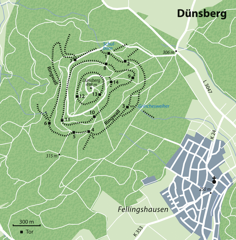
Deutsch: Karte des Dünsbergs bei Fellingshausen
English: Map of Dünsberg near Fellingshausen, Germany |
||||||||||||
| Date | |||||||||||||
| Source | Own work using OpenStreetMap | ||||||||||||
| Author | NordNordWest | ||||||||||||
| Permission (Reusing this file) |
|

|
This map has been made or improved in the German Kartenwerkstatt (Map Lab). You can propose maps to improve as well.
|
File history
Click on a date/time to view the file as it appeared at that time.
| Date/Time | Thumbnail | Dimensions | User | Comment | |
|---|---|---|---|---|---|
| current | 19:31, 14 January 2012 | | 2,158 × 2,196 (2.85 MB) | NordNordWest (talk | contribs) | upd |
| 19:47, 3 January 2012 |  | 2,158 × 2,196 (2.84 MB) | NordNordWest (talk | contribs) | =={{int:filedesc}}== {{Information |Description= {{de|Karte des Dünsbergs bei Hofheim am Taunus}} {{en|Map of Kapellenberg near Hofheim am Taunus, Germany}} |Source={{Own}} using OpenStreetMap |Date=2012-01-03 |Author={{U|NordNordWest} |
You cannot overwrite this file.
File usage on Commons
The following page uses this file:
File usage on other wikis
The following other wikis use this file: