File:Karte Drei Bünde.jpg
Size of this preview: 769 × 600 pixels. Other resolutions: 308 × 240 pixels | 615 × 480 pixels | 985 × 768 pixels | 1,280 × 999 pixels | 2,192 × 1,710 pixels.
Original file (2,192 × 1,710 pixels, file size: 1.51 MB, MIME type: image/jpeg)
Captions
Captions
Add a one-line explanation of what this file represents
Summary edit
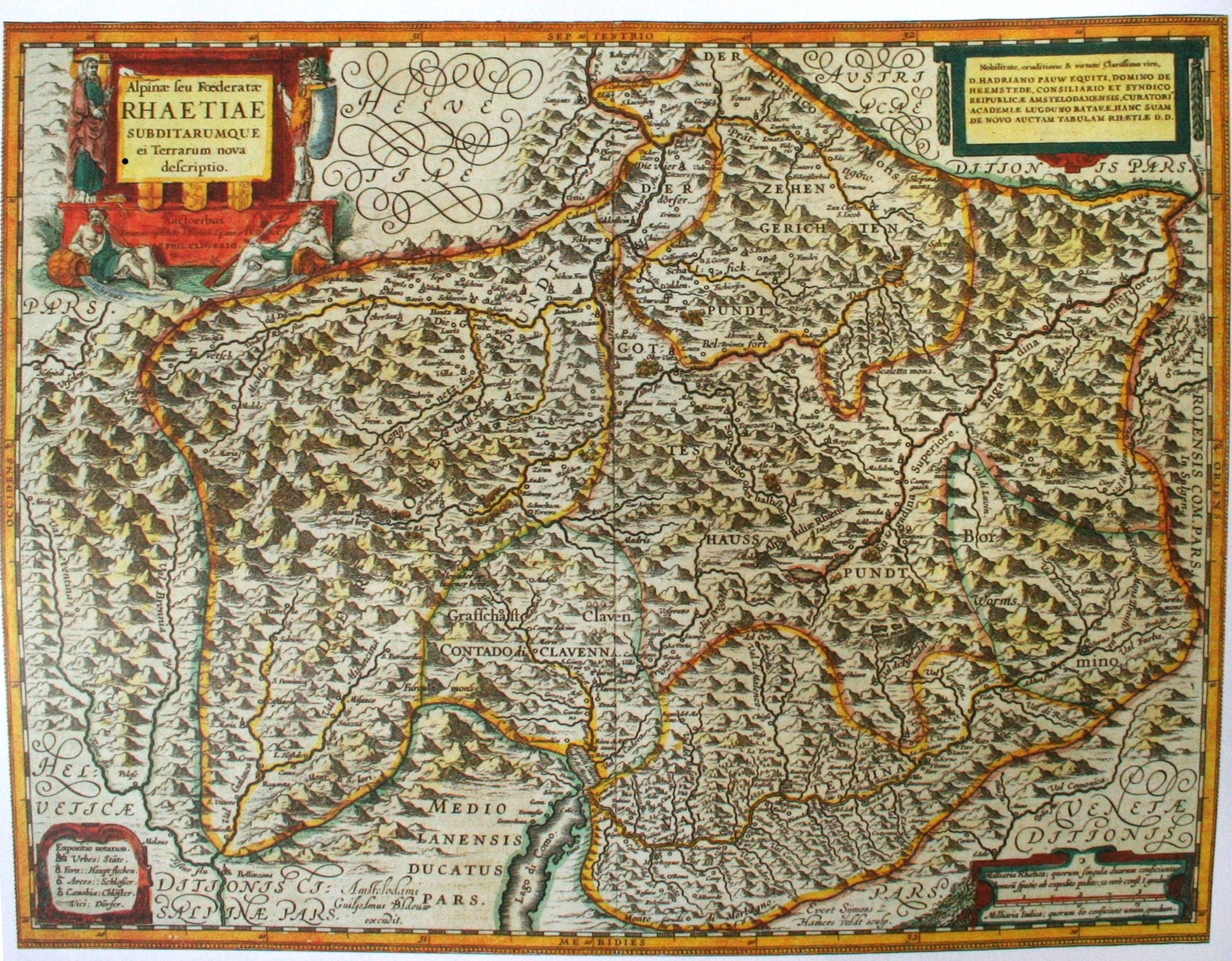
| Description | Alpine seu foederatae Rheatiae subditarumque ei terrarum nova descriptia (neue Beschreibung des alpinen oder bündnerischen Rätien und seinen Untertanengbiete); Karte von de:Fortunat Sprecher und de:Philipp Clüver der Drei Bünde und deren Untertanengebiete von 1618; die bekannteste und genauste Bündner Karte der frühen Neuzeit. |
| Date | |
| Source | Handbuch der Bündner Geschichte: Band 2; Frühe Neuzeit; Chur 2005 |
| Author | Sprecher/Clüver, upload by Adrian Michael |
| Permission (Reusing this file) |
Public domain due to age |
Licensing edit
|
This work is in the public domain in its country of origin and other countries and areas where the copyright term is the author's life plus 100 years or fewer. | |
| This file has been identified as being free of known restrictions under copyright law, including all related and neighboring rights. | |
File history
Click on a date/time to view the file as it appeared at that time.
| Date/Time | Thumbnail | Dimensions | User | Comment | |
|---|---|---|---|---|---|
| current | 16:39, 20 March 2010 | | 2,192 × 1,710 (1.51 MB) | Parpan05 (talk | contribs) | == {{int:filedesc}} == {{Information |Description=''Alpine seu foederatae Rheatiae subditarumque ei terrarum nova descriptia'' (neue Beschreibung des alpinen oder bündnerischen Rätien und seinen Untertanengbiete); Karte von de:Fortunat Sprecher und |
You cannot overwrite this file.
File usage on Commons
There are no pages that use this file.
File usage on other wikis
The following other wikis use this file:
- Usage on als.wikipedia.org
- Usage on de.wikipedia.org
- Usage on it.wikipedia.org