File:Karte Erste Stammstrecke Muenchen.png
Size of this preview: 800 × 403 pixels. Other resolutions: 320 × 161 pixels | 640 × 322 pixels | 1,024 × 516 pixels | 1,280 × 645 pixels | 2,560 × 1,290 pixels | 7,181 × 3,618 pixels.
Original file (7,181 × 3,618 pixels, file size: 6.17 MB, MIME type: image/png)
Captions
Captions
Add a one-line explanation of what this file represents
| Description |
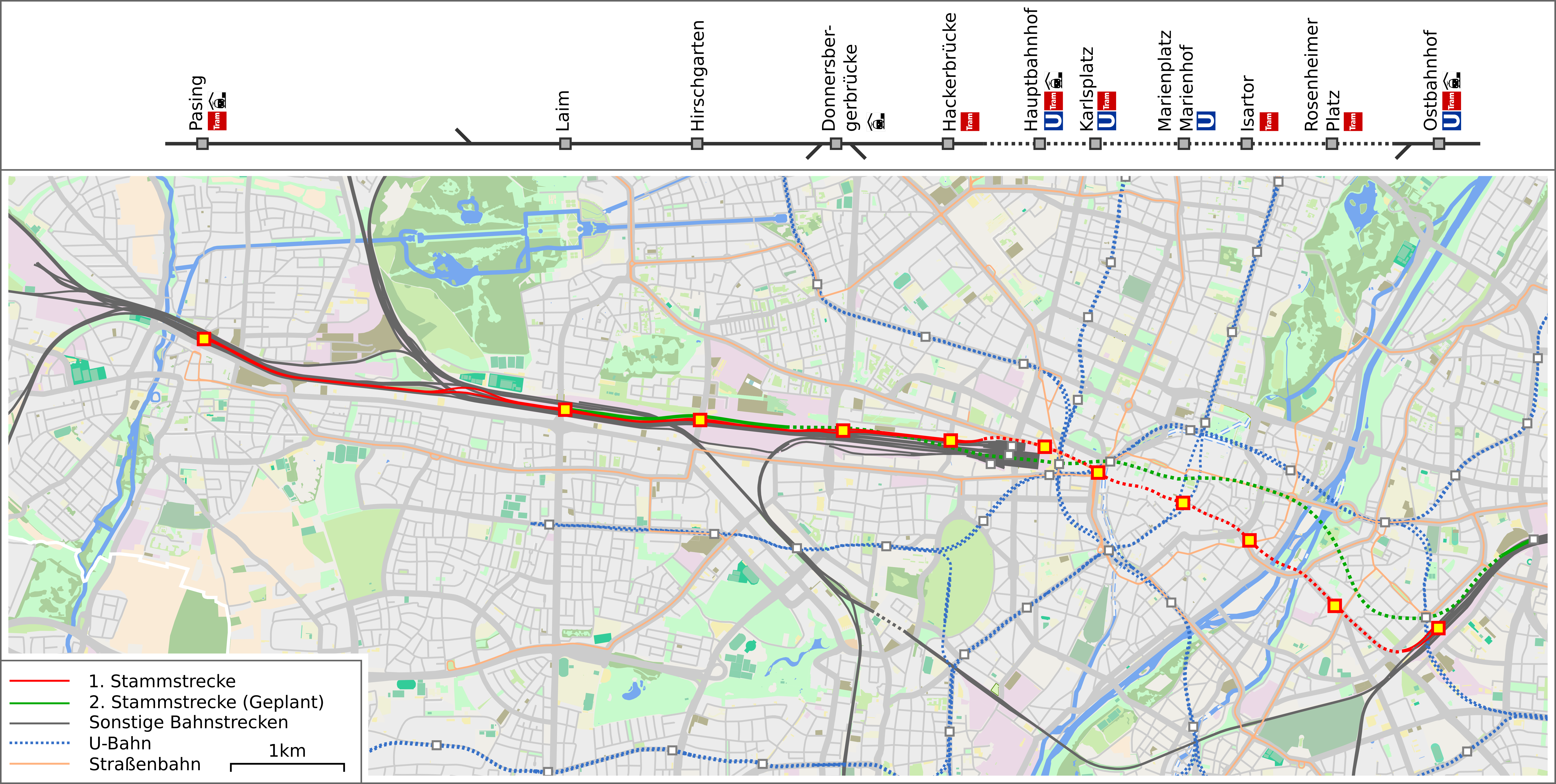
Deutsch: Karte der Stammstrecke der Münchner S-Bahn |
| Date | |
| Source | OpenStreetMap data exported and adapted by myself |
| Author |
|
| Description |
This map was created from OpenStreetMap project data, collected by the community. This map may be incomplete, and may contain errors. Don't rely solely on it for navigation. |
|||
| Date | (see file history) | |||
| Source | openstreetmap.org | |||
| Creator |
OpenStreetMap contributors |
|||
| Permission (Reusing this file) |
OpenStreetMap data is available under the Open Database License (details). Map tiles are licensed under the Creative Commons Attribution-ShareAlike 2.0 license (CC-BY-SA 2.0).
This file is licensed under the Creative Commons Attribution-Share Alike 2.0 Generic license.
|
|||
| Georeferencing | If inappropriate please set warp_status = skip to hide. |
File history
Click on a date/time to view the file as it appeared at that time.
| Date/Time | Thumbnail | Dimensions | User | Comment | |
|---|---|---|---|---|---|
| current | 10:06, 30 October 2016 | | 7,181 × 3,618 (6.17 MB) | Drlellinger (talk | contribs) | Hackerbrücke als Trambahnhaltestelle deklariert, Donnersbergerbrücke als Regionalzughalt deklariert |
| 18:54, 14 December 2015 |  | 7,181 × 3,618 (5.23 MB) | Vuxi (talk | contribs) | {{Information |description={{de|1=Karte der geplanten Ersten Stammstrecke der Münchner S-Bahn}} |date=2015-12-14 |source=OpenStreetMap data exported and adapted by myself |author=*map by OpenStreetMap contributors, All OpenStreetMap data and maps are... |
You cannot overwrite this file.
File usage on Commons
The following 10 pages use this file:
- User:Chumwa/OgreBot/München/2015 December 11-20
- User:Chumwa/OgreBot/München/2016 October 21-31
- User:Chumwa/OgreBot/Potential transport maps/2016 October 21-31
- User:Chumwa/OgreBot/Public transport information/2015 December 11-20
- User:Chumwa/OgreBot/Public transport information/2016 October 21-31
- User:Chumwa/OgreBot/Transport Maps/2015 December 11-20
- User:Chumwa/OgreBot/Transport Maps/2016 October 21-31
- User:Chumwa/OgreBot/Travel and communication maps/2016 October 21-31
- User:Nordlicht8/Rail Germany/2015 December 11-20
- Category:Stammstrecke (S-Bahn München)
File usage on other wikis
The following other wikis use this file:
- Usage on de.wikipedia.org
- Usage on en.wikipedia.org
- Usage on hu.wikipedia.org
- Usage on www.wikidata.org