File:Karte Rosenheimer See.jpg
Size of this preview: 800 × 594 pixels. Other resolutions: 320 × 238 pixels | 640 × 475 pixels | 1,024 × 760 pixels | 1,280 × 950 pixels | 2,171 × 1,612 pixels.
Original file (2,171 × 1,612 pixels, file size: 1.39 MB, MIME type: image/jpeg)
Captions
Captions
Add a one-line explanation of what this file represents
| Description |
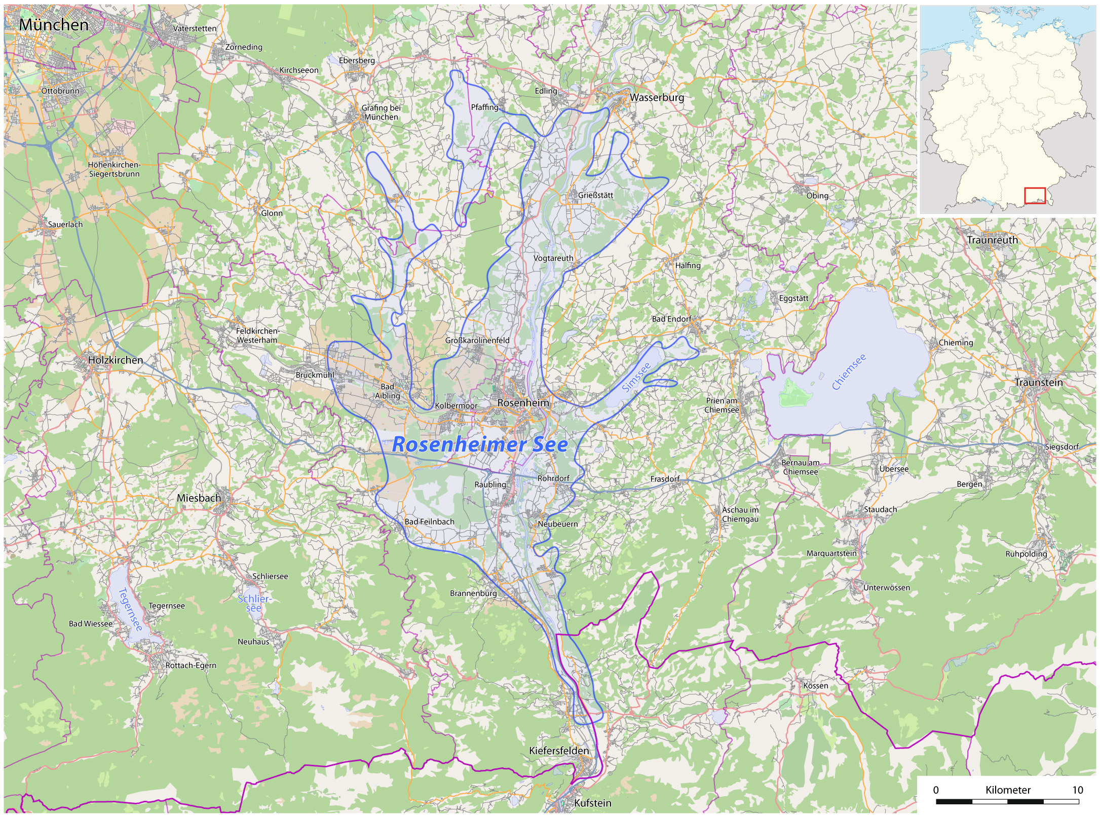
Deutsch: Lage des ehemaligen Rosenheimer Sees |
| Date | see file history |
| Source | own work, using OpenStreetMap and this map |
| Author | Maximilian Dörrbecker (Chumwa) |
| Permission (Reusing this file) |
All OpenStreetMap data and maps are Creative Commons "CC-BY-SA 2.0" licensed This file is licensed under the Creative Commons Attribution-Share Alike 2.0 Generic license.
|
File history
Click on a date/time to view the file as it appeared at that time.
| Date/Time | Thumbnail | Dimensions | User | Comment | |
|---|---|---|---|---|---|
| current | 21:29, 13 March 2011 | | 2,171 × 1,612 (1.39 MB) | Chumwa (talk | contribs) | Information |Description={{de|Lage des ehemaligen Rosenheimer Sees}} |Author=Maximilian Dörrbecker (Chumwa) |Source=own work, using OpenStreetMap and [http://www.ovb-online.de/lokales/rosenheim/l |
You cannot overwrite this file.
File usage on Commons
The following page uses this file:
File usage on other wikis
The following other wikis use this file:
- Usage on de.wikipedia.org
- Usage on fr.wikipedia.org
- Usage on nl.wikipedia.org