File:Karte Seenlandbahn.png
Size of this preview: 800 × 397 pixels. Other resolutions: 320 × 159 pixels | 954 × 474 pixels.
Original file (954 × 474 pixels, file size: 300 KB, MIME type: image/png)
Captions
Captions
Add a one-line explanation of what this file represents
| Description |
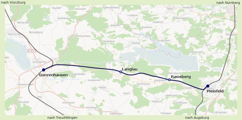
English: Map of the Gunzenhausen–Pleinfeld railway from Gunzenhausen to Pleinfeld.
Deutsch: Karte der Seenlandbahn von Gunzenhausen nach Pleinfeld. |
| Date | |
| Source | Eigenes Werk (own work), using OpenStreetMap Data |
| Author |
Graphic made by Carport |
| Permission (Reusing this file) |
All OpenStreetMap data and maps are Creative Commons "CC-BY-SA 2.0" licensed This file is licensed under the Creative Commons Attribution-Share Alike 2.0 Generic license.
|
File history
Click on a date/time to view the file as it appeared at that time.
| Date/Time | Thumbnail | Dimensions | User | Comment | |
|---|---|---|---|---|---|
| current | 14:38, 14 July 2009 | | 954 × 474 (300 KB) | Carport (talk | contribs) | {{Information |Description={{en|1=Map of the Gunzenhausen–Pleinfeld railway from Gunzenhausen to Pleinfeld.}} {{de|1=Karte der Seenlandbahn von Gunzenhausen nach Pleinfeld.}} |Source=Eigene |
You cannot overwrite this file.
File usage on Commons
There are no pages that use this file.
File usage on other wikis
The following other wikis use this file:
- Usage on de.wikipedia.org
- Usage on hu.wikipedia.org
- Usage on www.wikidata.org