File:Karte Strassenbahn Biel 1925.png
Original file (1,515 × 911 pixels, file size: 2.64 MB, MIME type: image/png)
Captions
Captions
Summary edit
| Description |
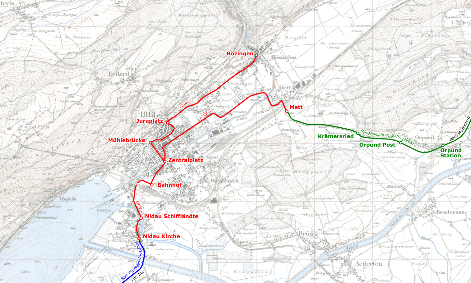
Deutsch: Linien der Strassenbahn Biel im Jahre 1925 |
|||||||||
| Date | ||||||||||
| Source | ||||||||||
| Creator |
|
|||||||||
| Permission (Reusing this file) |
|
|||||||||
| Geotemporal data | ||||||||||
| Bounding box |
|
|||||||||
| Georeferencing | ||||||||||
File history
Click on a date/time to view the file as it appeared at that time.
| Date/Time | Thumbnail | Dimensions | User | Comment | |
|---|---|---|---|---|---|
| current | 12:02, 16 January 2020 | | 1,515 × 911 (2.64 MB) | Pechristener (talk | contribs) | == {{int:filedesc}} == {{map |description={{de|Linien der Strassenbahn Biel im Jahre 1925}} |date=2020-01-16 |source= * Hintergrund: ** Siegfriedkarte, Blatt 121 ''Orvin'', 1925: [https://map.geo.admin.ch/] ** Siegfriedkarte, Blatt 124 ''Biel'', 1925: [https://map.geo.admin.ch/] * Strecken-Eintrag nach oben genannter Siegfriedkarten und Luftbilder [https://map.geo.admin.ch/] |author= * Siegfriedkarte: Eidgenössisches Stabsbureau (heute Bundesamt für Landestopografie) * Markierungen Tramlinie... |
You cannot overwrite this file.
File usage on Commons
The following 3 pages use this file:
File usage on other wikis
The following other wikis use this file:
- Usage on de.wikipedia.org
- Usage on www.wikidata.org