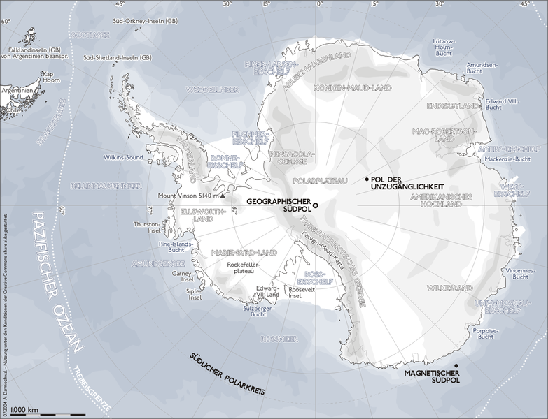
File:Karte antarktis2 geo.png

Size of this preview: 783 × 600 pixels. Other resolutions: 313 × 240 pixels | 627 × 480 pixels | 1,003 × 768 pixels | 1,300 × 996 pixels.
Original file (1,300 × 996 pixels, file size: 511 KB, MIME type: image/png)
File information
Structured data
Captions
Captions
South Pole
Südpol
| DescriptionKarte antarktis2 geo.png |
Deutsch: eigene Darstellung English: Used on de:Vorlage:Positionskarte Antarktis |
| Date | 14 January 2005 (original upload date) |
| Source | Transferred from de.wikipedia to Commons by Hardscarf using CommonsHelper. |
| Author | The original uploader was Sansculotte at German Wikipedia. |
| Permission (Reusing this file) |
This file is licensed under the Creative Commons Attribution-Share Alike 2.0 Generic license.
|
Original upload log
editThe original description page was here. All following user names refer to de.wikipedia.
- 2005-01-14 17:40 Sansculotte 1300×996×8 (523449 bytes) eigene Darstellung, {{Bild-CC-by-sa}}
File history
Click on a date/time to view the file as it appeared at that time.
| Date/Time | Thumbnail | Dimensions | User | Comment | |
|---|---|---|---|---|---|
| current | 10:11, 3 June 2008 |  | 1,300 × 996 (511 KB) | File Upload Bot (Magnus Manske) (talk | contribs) | {{BotMoveToCommons|de.wikipedia}} {{Information |Description={{de|eigene Darstellung,}} |Source=Transferred from [http://de.wikipedia.org de.wikipedia]; transfered to Commons by User:Hardscarf using [http://tools.wikimedia.de/~magnus/commonshelper.ph |
You cannot overwrite this file.
File usage on Commons
There are no pages that use this file.
File usage on other wikis
The following other wikis use this file:
- Usage on als.wikipedia.org
- Usage on ann.wikipedia.org
- Usage on bar.wikipedia.org
- Usage on de.wikipedia.org
- Usage on ka.wikipedia.org
- Usage on lb.wikipedia.org
- Usage on nds.wikipedia.org
- Usage on ro.wikipedia.org
- Usage on xmf.wikipedia.org