File:Karte der Inselbahn Langeoog.png

Size of this preview: 800 × 417 pixels. Other resolutions: 320 × 167 pixels | 640 × 334 pixels | 1,024 × 534 pixels | 1,899 × 991 pixels.
Original file (1,899 × 991 pixels, file size: 285 KB, MIME type: image/png)
Captions
Captions
Add a one-line explanation of what this file represents
| Description |
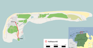
Deutsch: Verlaufskarte der Inselbahn Langeoog |
| Date | see file history |
| Source |
own, using
|
| Author |
|
| Permission (Reusing this file) |
All OpenStreetMap data and maps are Creative Commons "CC-BY-SA 2.0" licensed This file is licensed under the Creative Commons Attribution-Share Alike 2.0 Generic license.
|
File history
Click on a date/time to view the file as it appeared at that time.
| Date/Time | Thumbnail | Dimensions | User | Comment | |
|---|---|---|---|---|---|
| current | 11:41, 26 November 2011 | | 1,899 × 991 (285 KB) | Dr.Haus (talk | contribs) | {{Information |Description={{de|Verlaufskarte der Inselbahn Langeoog}} |Author=* OpenStreetMap contributors (background) * Dr.Haus |Source=own, using * www.openstreetmap.org data for the background * [[:File:Ostfriesland de.svg|this file] |
You cannot overwrite this file.
File usage on Commons
The following 3 pages use this file:
File usage on other wikis
The following other wikis use this file:
- Usage on de.wikipedia.org
- Usage on www.wikidata.org