File:Karte des Deutschen Reiches (5820004).jpg

Size of this preview: 444 × 599 pixels. Other resolutions: 178 × 240 pixels | 356 × 480 pixels | 569 × 768 pixels | 759 × 1,024 pixels | 1,519 × 2,048 pixels | 10,421 × 14,051 pixels.
Original file (10,421 × 14,051 pixels, file size: 56.94 MB, MIME type: image/jpeg)
Captions
Captions
Add a one-line explanation of what this file represents
Summary
edit.jpg&action=edit§ion=1)
| Description |
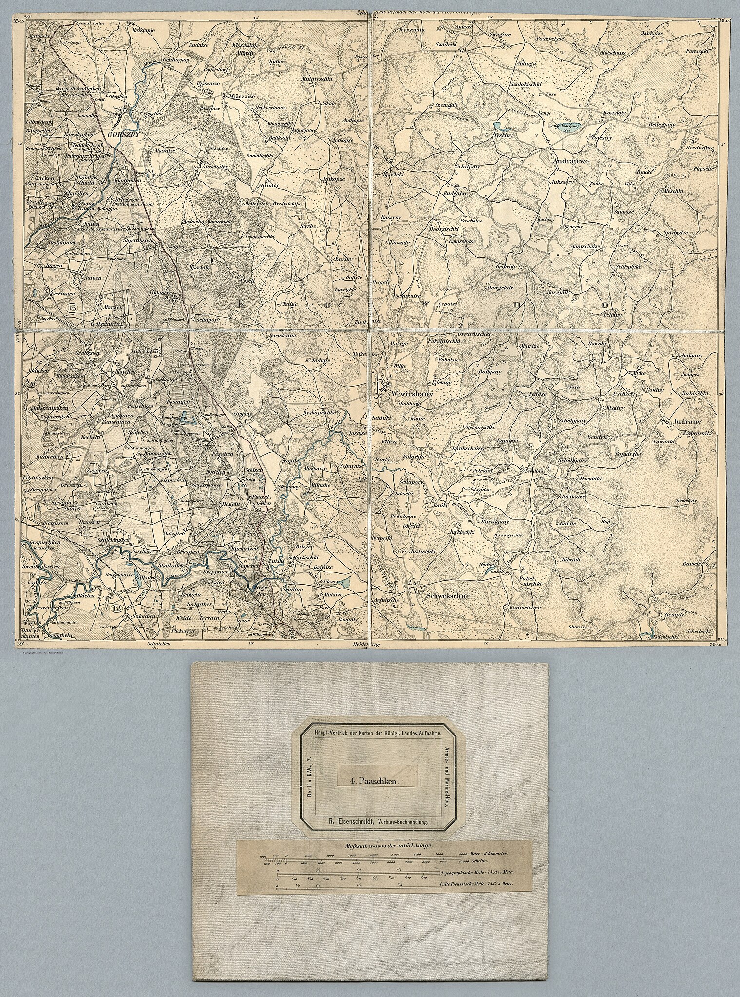
Deutsch: Zeichen-Erklaerung fur die Karte des Deutschen Reiches, 674 Blätter und zusammengesetzte Karten. Herausgegeben für die Generalstäbe Bayerns, Preußens, Sachsens und Württembergs bei R. Eisenschmidt, Verlags-Buchhandlung, Berlin. Maßstab 1:100.000.
English: Zeichen-Erklaerung fur die Karte des Deutschen Reiches, 674 sheets and composite maps. Published for the General Staffs of Bavaria, Prussia, Saxony and Wurttemberg by R. Eisenschmidt, Verlags-Buchhandlung, Berlin. Scale 1:100,000.
Français : Zeichen-Erklaerung fur die Karte des Deutschen Reiches, 674 feuilles plus cartes composées. Publié pour les états-majors généraux de Bavière, Prusse, Saxe et Wurtemberg par R. Eisenschmidt, Verlags-Buchhandlung, Berlin. échelle 1/100 000. |
| Date | |
| Source | list, main |
| Author | Reichsamt fur Landesaufnahme |
Licensing
edit.jpg&action=edit§ion=2)
|
This is a faithful photographic reproduction of a two-dimensional, public domain work of art. The work of art itself is in the public domain for the following reason:
The official position taken by the Wikimedia Foundation is that "faithful reproductions of two-dimensional public domain works of art are public domain".
This photographic reproduction is therefore also considered to be in the public domain in the United States. In other jurisdictions, re-use of this content may be restricted; see Reuse of PD-Art photographs for details. | ||||
File history
Click on a date/time to view the file as it appeared at that time.
| Date/Time | Thumbnail | Dimensions | User | Comment | |
|---|---|---|---|---|---|
| current | 19:03, 19 August 2023 | | 10,421 × 14,051 (56.94 MB) | YannBot (talk | contribs) | == {{int:filedesc}} == {{Information |Description={{de|1=''Zeichen-Erklaerung fur die Karte des Deutschen Reiches'', 674 Blätter und zusammengesetzte Karten. Herausgegeben für die Generalstäbe Bayerns, Preußens, Sachsens und Württembergs bei R. Eisenschmidt, Verlags-Buchhandlung, Berlin. Maßstab 1:100.000.}} {{en|1=''Zeichen-Erklaerung fur die Karte des Deutschen Reiches'', 674 sheets and composite maps. Published for the General Staffs of Bavaria, Prussia, Saxony and Wurttemberg by R. Eisens... |
You cannot overwrite this file.
File usage on Commons
The following page uses this file:
.jpg)
.jpg&oldid=809836751)