File:Karte mit alter weisseritz.JPG

Size of this preview: 439 × 599 pixels. Other resolutions: 176 × 240 pixels | 351 × 480 pixels | 562 × 768 pixels | 750 × 1,024 pixels | 1,633 × 2,230 pixels.
Original file (1,633 × 2,230 pixels, file size: 818 KB, MIME type: image/jpeg)
Captions
Captions
Add a one-line explanation of what this file represents
| Description |
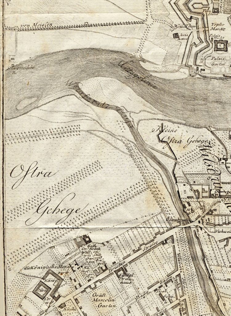
English: city map of Dresden (part of plan with Ostragehege), J. Georg Lehmann, delineated 1801, improved 1804, printed 1809
Deutsch: Stadtplan von Dresden (Ausschnitt mit Ostragehege) von J. Georg Lehmann, gezeichnet 1801, verbessert 1804, gedruckt 1809 |
| Date | |
| Source | Eigenes Scan (own scan) |
| Author | Lysippos |
|
This work is in the public domain in its country of origin and other countries and areas where the copyright term is the author's life plus 100 years or fewer. | |
| This file has been identified as being free of known restrictions under copyright law, including all related and neighboring rights. | |
source: [Friedrich Christian August Hasse]: Dresden und die umliegende Gegend bis Elsterwerda, Bautzen, Herrnhut, Rumburg, Aussig, Töplitz, Freyberg und Hubertusburg. Eine Darstellung für Natur- und Kunstfreunde. Erster Theil. 2. vermehrte Auflage, Dresden (Arnoldsche Buch- und Kunsthandlung) 1804
File history
Click on a date/time to view the file as it appeared at that time.
| Date/Time | Thumbnail | Dimensions | User | Comment | |
|---|---|---|---|---|---|
| current | 00:44, 28 August 2009 | | 1,633 × 2,230 (818 KB) | Lysippos (talk | contribs) | {{Information |Description={{en|1=city map of Dresden (part of plan with Ostragehege), J. Georg Lehmann, delineated 1801, improved 1804, printed 1809}} {{de|1=Stadtplan von Dresden (Ausschnitt mit Ostragehege) von J. Georg Lehmann, gezeichnet 1801, verbes |
You cannot overwrite this file.
File usage on Commons
There are no pages that use this file.
File usage on other wikis
The following other wikis use this file:
- Usage on de.wikipedia.org
- Usage on www.wikidata.org