File:Karte von Montana.jpg

Size of this preview: 800 × 465 pixels. Other resolutions: 320 × 186 pixels | 640 × 372 pixels | 892 × 518 pixels.
Original file (892 × 518 pixels, file size: 87 KB, MIME type: image/jpeg)
Captions
Captions
Add a one-line explanation of what this file represents
Summary
edit
| Description |
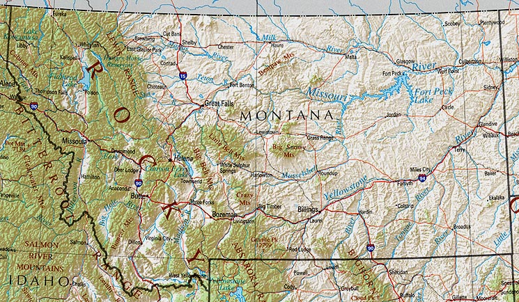
Deutsch: Karte von Montana |
| Date | 20 July 2004 (original upload date) |
| Source |
|
| Author | U.S. Geological Survey 2001, Printed 2002 (2.8MB) |
Licensing
edit
This image is in the public domain in the United States because it only contains materials that originally came from the United States Geological Survey, an agency of the United States Department of the Interior. For more information, see the official USGS copyright policy.
|
| This work is ineligible for copyright and therefore in the public domain because it consists entirely of information that is common property and contains no original authorship. |
Original upload log
edit
Transferred from de.wikipedia to Commons by Nachcommonsverschieber using CommonsHelper.
The original description page was here. All following user names refer to de.wikipedia.
- 2004-07-20 15:02 Johannes@wiki 892×518× (88658 bytes) Public Domain von http://www.lib.utexas.edu/, nachbearbeitet von mir!
File history
Click on a date/time to view the file as it appeared at that time.
| Date/Time | Thumbnail | Dimensions | User | Comment | |
|---|---|---|---|---|---|
| current | 10:12, 6 July 2013 | | 892 × 518 (87 KB) | File Upload Bot (Magnus Manske) (talk | contribs) | Transfered from de.wikipedia by User:Nachcommonsverschieber using CommonsHelper |
You cannot overwrite this file.
File usage on Commons
There are no pages that use this file.
File usage on other wikis
The following other wikis use this file:
- Usage on de.wikipedia.org