File:Karte von Tumringen, Rötteln und Umgebung.jpg
Size of this preview: 800 × 572 pixels. Other resolutions: 320 × 229 pixels | 640 × 458 pixels | 1,024 × 733 pixels | 1,280 × 916 pixels | 2,560 × 1,831 pixels | 5,259 × 3,762 pixels.
Original file (5,259 × 3,762 pixels, file size: 5.45 MB, MIME type: image/jpeg)
Captions
Captions
Add a one-line explanation of what this file represents
Summary
edit
| Description |
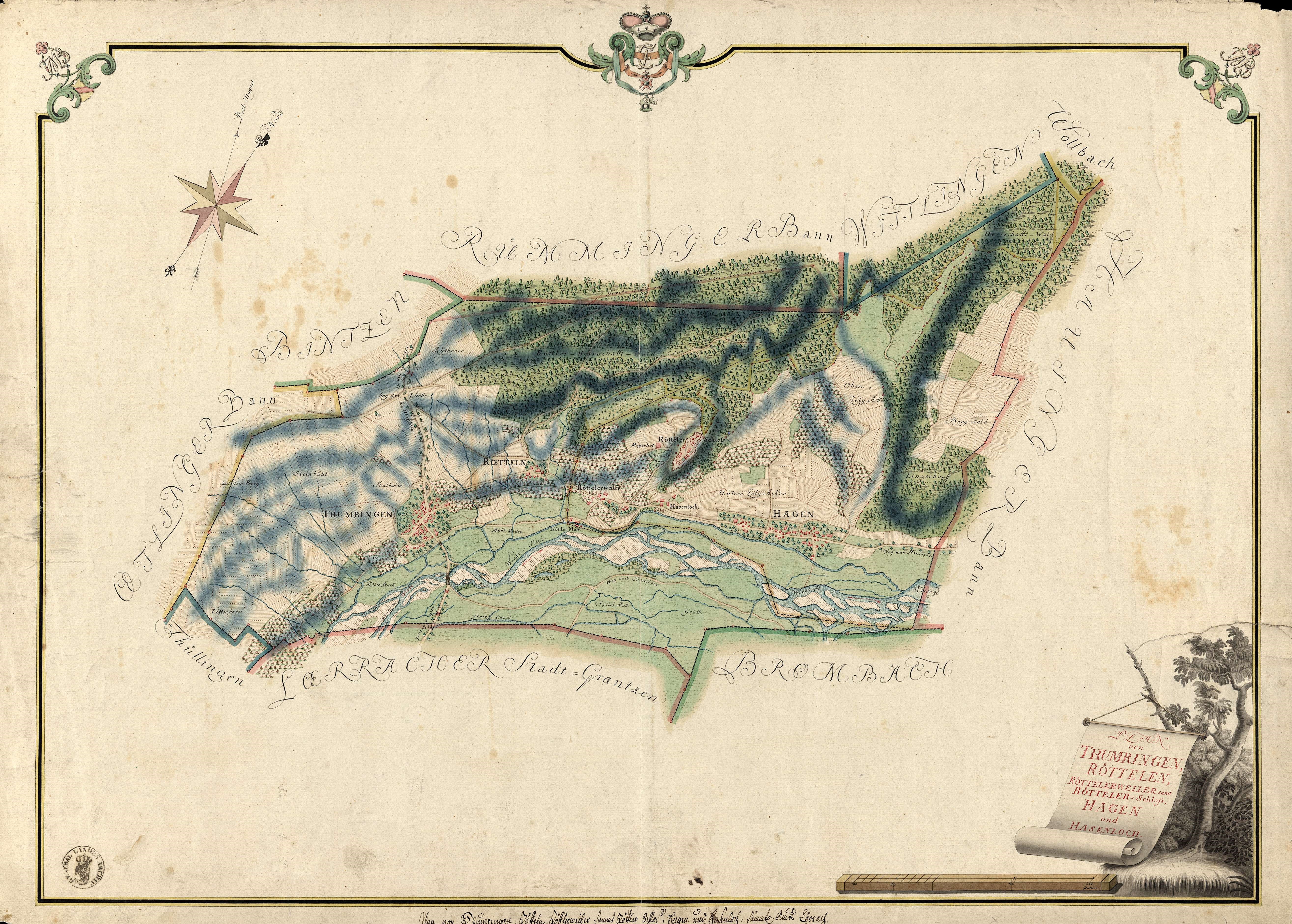
Deutsch: Karte von Tumringen, Rötteln und Umgebung |
|||||
| Date | ||||||
| Source | https://www.leo-bw.de/web/guest/detail/-/Detail/details/DOKUMENT/labw_findmittel_02/labw-4-1752695/%22Plan+von+Thumringen+Rötteln+Röttelerweiler+samt+Rötteler-Schloß+Hagen+und+Hasenloch%22 | |||||
| Author | Unknown author | |||||
| Permission (Reusing this file) |
|
|||||
File history
Click on a date/time to view the file as it appeared at that time.
| Date/Time | Thumbnail | Dimensions | User | Comment | |
|---|---|---|---|---|---|
| current | 10:30, 28 May 2019 | | 5,259 × 3,762 (5.45 MB) | Alabasterstein (talk | contribs) | {{Information |description ={{de|1=Karte von Tumringen, Rötteln und Umgebung}} |date =1777 |source =https://www.leo-bw.de/web/guest/detail/-/Detail/details/DOKUMENT/labw_findmittel_02/labw-4-1752695/%22Plan+von+Thumringen+Rötteln+Röttelerweiler+samt+Rötteler-Schloß+Hagen+und+Hasenloch%22 |author ={{unknown|author}} |permission ={{PD-Art-100}} }} Category:Maps of Lörrach Category:Tumringen Category:Rötteln Category:1777 in Baden-Württemberg |
You cannot overwrite this file.
File usage on Commons
There are no pages that use this file.