File:Karte von der Insel Grenada und den Grenadillen in Nord America, unter den zwölften Grad der Breite. LOC 74690601.tif

Size of this JPG preview of this TIF file: 800 × 588 pixels. Other resolutions: 320 × 235 pixels | 640 × 470 pixels | 1,024 × 752 pixels | 1,280 × 940 pixels | 2,560 × 1,880 pixels | 3,904 × 2,867 pixels.
Original file (3,904 × 2,867 pixels, file size: 32.02 MB, MIME type: image/tiff)
Captions
Captions
Add a one-line explanation of what this file represents
Summary edit
| Description |
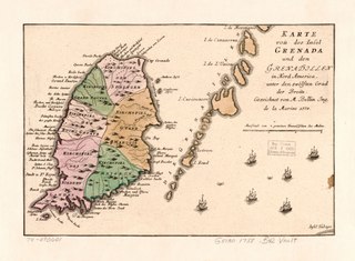
English: Scale ca. 1:65,000. Relief shown pictorially. Hand colored. Pictorial map. Appears in Christoph H. Korn's Geschichte der Kriege in und ausser Europa. 1780. [v. 3] no. 142. Shows administrative boundaries. LC Maps of North America, 1750-1789, 2099 Available also through the Library of Congress Web site as a raster image. Vault AACR2 |
||
| Title | Karte von der Insel Grenada und den Grenadillen in Nord America, unter den zwölften Grad der Breite. | ||
| Shelf ID | G5130 1758 .B42 | ||
| Date | |||
| Source | https://www.loc.gov/item/74690601/ | ||
| Author | Bellin, Jacques Nicolas | ||
| Permission (Reusing this file) |
|
||
| Other versions |
|
||
| Location | Grenada · Grenada. | ||
| Part of | Military Battles And Campaigns · American Memory · Catalog · Geography And Map Division · American Revolution And Its Era: Maps And Charts Of North America And The West Indies, 1750-1789 | ||
| Subject | Grenada · Early Works To 1800 · Administrative And Political Divisions · Maps |


Licensing edit
|
This is a faithful photographic reproduction of a two-dimensional, public domain work of art. The work of art itself is in the public domain for the following reason:
The official position taken by the Wikimedia Foundation is that "faithful reproductions of two-dimensional public domain works of art are public domain".
This photographic reproduction is therefore also considered to be in the public domain in the United States. In other jurisdictions, re-use of this content may be restricted; see Reuse of PD-Art photographs for details. | ||||
File history
Click on a date/time to view the file as it appeared at that time.
| Date/Time | Thumbnail | Dimensions | User | Comment | |
|---|---|---|---|---|---|
| current | 12:02, 21 August 2019 |  | 3,904 × 2,867 (32.02 MB) | Fæ (talk | contribs) | LOC Maps https://www.loc.gov/item/74690601/ #17823 |
You cannot overwrite this file.
File usage on Commons
The following page uses this file: