File:Katama & South Beach.jpg
Original file (1,280 × 960 pixels, file size: 302 KB, MIME type: image/jpeg)
Captions
Captions
| I, the copyright holder of this work, release this work into the public domain. This applies worldwide. In some countries this may not be legally possible; if so: I grant anyone the right to use this work for any purpose, without any conditions, unless such conditions are required by law. |
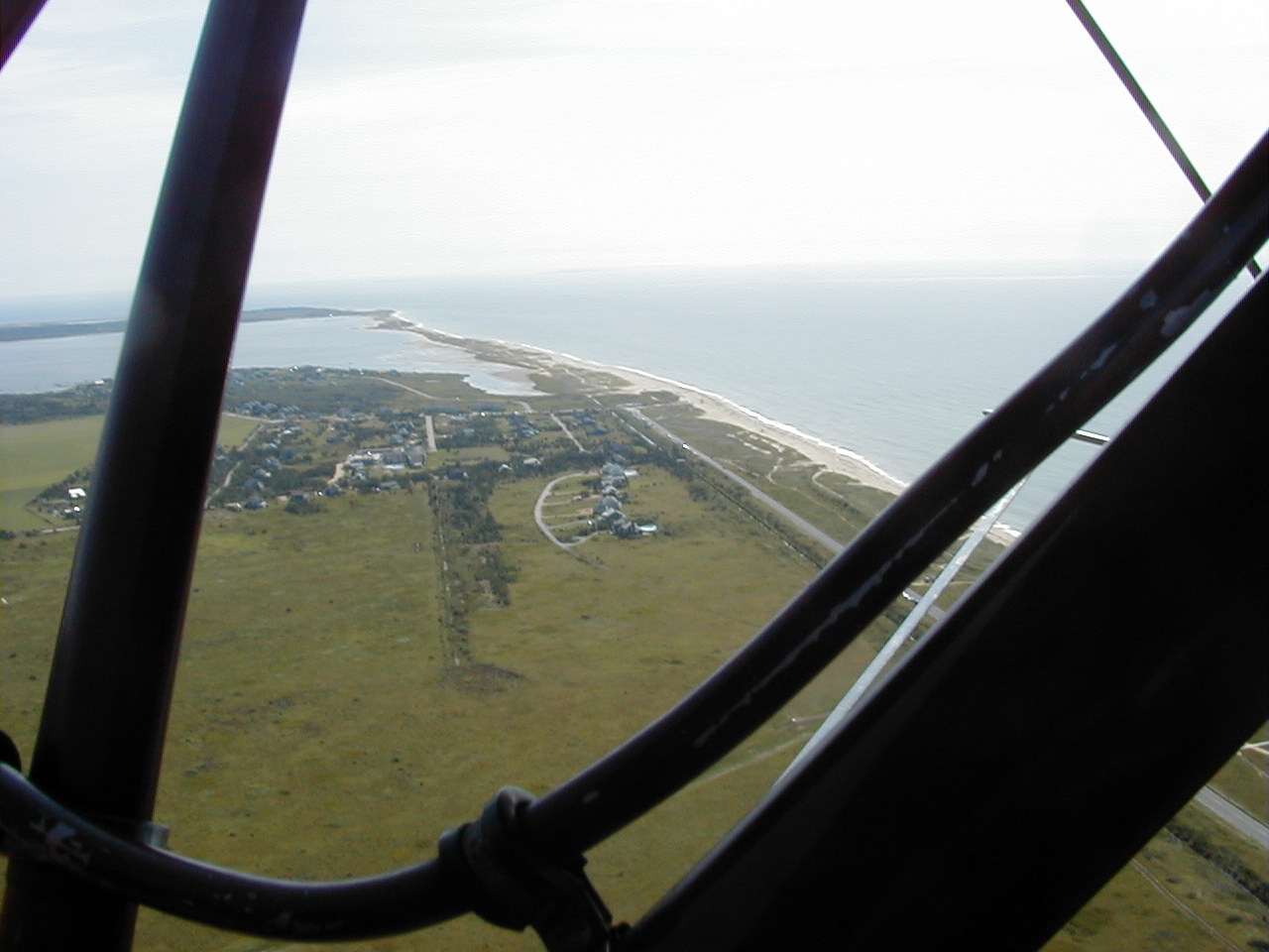
This is an aerial photograph taken in 2000 showing the Mattakessett area of Katama of Martha's Vineyard Island including South Beach. The photo looks to the east. Directly below is conservation land adjacent to the southern end of Katama (Edgartown) airfield. The Mattakessett region of Katama is shown in the central portion of the photograph and is developed with housing. Katama Bay is shown between the distant land mass (Chappaquiddick island) and Katama. South Beach (right side of photo) extends the entire length of Martha's Vineyard island. In this photo it also forms the southern boundary of Katama Bay. The most distant portion of South Beach (defined by the point at which the beach turns left (or north) is named Wasque Point. Submitted by Robert Gagel. I hereby assert that I am the creator of this contribution and agree to publish this text and photo under the GNU Free Documentation License.
I hereby assert that I am the creator of this contribution and it does not violate any third party rights. I agree to release this photo into the public domain. RFG
| Annotations | This image is annotated: View the annotations at Commons |
File history
Click on a date/time to view the file as it appeared at that time.
| Date/Time | Thumbnail | Dimensions | User | Comment | |
|---|---|---|---|---|---|
| current | 14:25, 25 November 2006 | | 1,280 × 960 (302 KB) | Rfgagel (talk | contribs) | This is an aerial photograph taken in 2000 showing the Mattakessett area of Katama of Martha's Vineyard Island including South Beach. The photo looks to the east. Directly below is conservation land adjacent to the southern end of Katama (Edgartown) airfi |
You cannot overwrite this file.
File usage on Commons
There are no pages that use this file.
File usage on other wikis
The following other wikis use this file:
- Usage on ceb.wikipedia.org
- Usage on de.wikipedia.org
- Usage on www.wikidata.org