File:Katrina 1999 rainfall.gif

Size of this preview: 763 × 600 pixels. Other resolutions: 306 × 240 pixels | 611 × 480 pixels | 977 × 768 pixels | 1,060 × 833 pixels.
Original file (1,060 × 833 pixels, file size: 22 KB, MIME type: image/gif)
Captions
Captions
Add a one-line explanation of what this file represents
Summary
| Description |
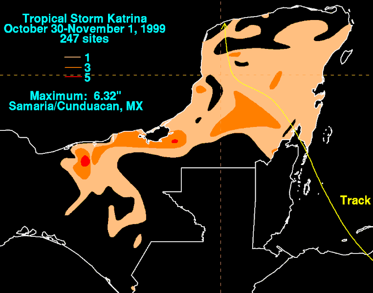
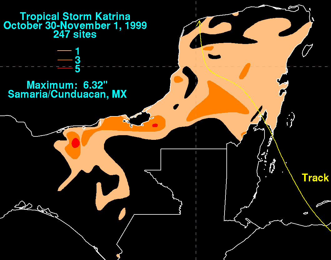
English: Storm total rainfall map of Tropical Storm Katrina during October and November 1999. |
|||
| Date | ||||
| Source | WPC tropical cyclone rainfall data | |||
| Author | David Roth, Weather Prediction Center, Camp Springs, Maryland | |||
| Permission (Reusing this file) |
|
File history
Click on a date/time to view the file as it appeared at that time.
| Date/Time | Thumbnail | Dimensions | User | Comment | |
|---|---|---|---|---|---|
| current | 02:08, 28 June 2009 | | 1,060 × 833 (22 KB) | Cyclonebiskit (talk | contribs) | {{Information |Description={{en|1=A cold front dropped down into the western Caribbean Sea on October 22. A broad area of low pressure formed over much of the Caribbean thereafter, with thunderstorm activity concentrated across the southwest Caribbean Se |
You cannot overwrite this file.
File usage on Commons
The following page uses this file:
- File:Katrina1999filledrainblk.gif (file redirect)
File usage on other wikis
The following other wikis use this file:
- Usage on en.wikipedia.org
- Usage on pt.wikipedia.org