File:Katsugigaura-suidō channel viewed from Matsugashima-bashi bridge.JPG

Size of this preview: 800 × 600 pixels. Other resolutions: 320 × 240 pixels | 640 × 480 pixels | 1,024 × 768 pixels | 1,280 × 960 pixels | 1,600 × 1,200 pixels.
Original file (1,600 × 1,200 pixels, file size: 361 KB, MIME type: image/jpeg)
Captions
Captions
Add a one-line explanation of what this file represents
Summary
edit
| Description |
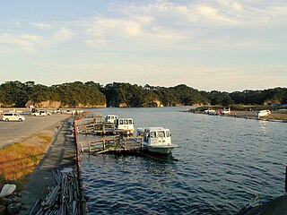
English: Katsugigaura-suidō channel between Nobiru beach and Miyato-jima island viewed from Matsugashima-bashi bridge
日本語: 野蒜海岸と宮戸島とをつなぐ松ヶ島橋から東向きに撮った潜ヶ浦水道(かつぎがうらすいどう)。日本三景・松島の嵯峨渓遊覧船が見える。 |
| Date | |
| Source | Own work |
| Author | neuropower |
| Camera location | | View this and other nearby images on: OpenStreetMap |
|---|
Licensing
edit
| I, the copyright holder of this work, release this work into the public domain. This applies worldwide. In some countries this may not be legally possible; if so: I grant anyone the right to use this work for any purpose, without any conditions, unless such conditions are required by law. |
File history
Click on a date/time to view the file as it appeared at that time.
| Date/Time | Thumbnail | Dimensions | User | Comment | |
|---|---|---|---|---|---|
| current | 10:07, 9 March 2010 | | 1,600 × 1,200 (361 KB) | Neuropower (talk | contribs) | {{Information |Description={{en|1=Katsugigaura-suidō channel between Nobiru beach and Miyato-jima island viewed from Matsugashima-bashi bridge}} {{ja|1=野蒜海岸と宮戸島とをつなぐ松ヶ島橋から東向きに撮った潜ヶ浦水道(かつ |
You cannot overwrite this file.
File usage on Commons
There are no pages that use this file.
File usage on other wikis
The following other wikis use this file:
- Usage on ja.wikipedia.org