File:Kauparve - KMB - 16001000146826.jpg
No higher resolution available.
Kauparve_-_KMB_-_16001000146826.jpg (787 × 522 pixels, file size: 98 KB, MIME type: image/jpeg)
Captions
Captions
Add a one-line explanation of what this file represents
| Kauparve
( |
|||||||||||||||||||||||||||
|---|---|---|---|---|---|---|---|---|---|---|---|---|---|---|---|---|---|---|---|---|---|---|---|---|---|---|---|
| Photographer |
|
||||||||||||||||||||||||||
| Title |
Kauparve |
||||||||||||||||||||||||||
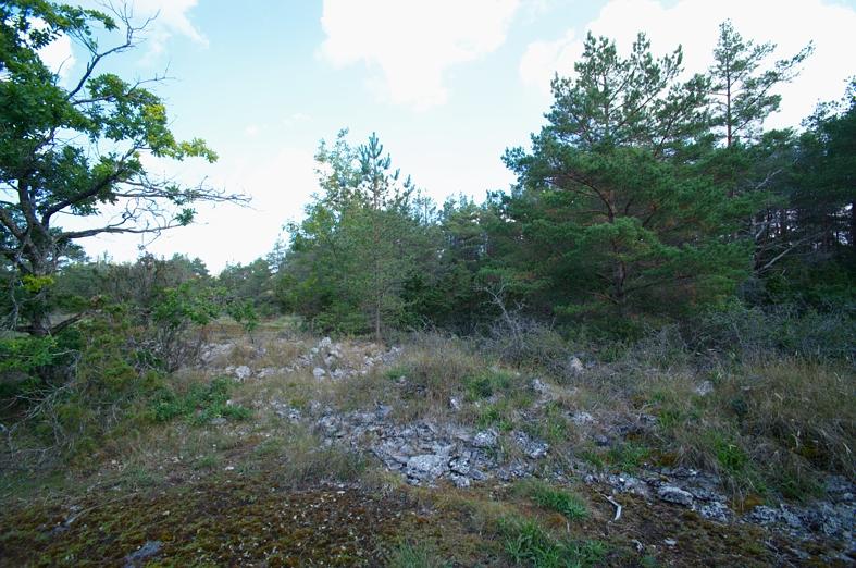
| Original caption |
Notera Av dokumentationsskäl har originalbeskrivningen från Riksantikvarieämbetet behållits. Tillrättalägganden och alternativa beskrivningar bör införas separat från nedanstående information. Lärbro 127:1. Röset har varit ca 3 m högt och 18 m i diameter. Den inre består av ett 2,5 m högt uppmurat torn. Innanför fann man två kistor av stenhällar. Av rösets yttre återstår idag endast en halmeterhög mur runt tornet.Felaktigheter kan även anmälas till denna sida. Motiv: Lärbro 127:1 |
||||||||||||||||||||||||||
| Description |
Lärbro 127:1. Röset har varit ca 3 m högt och 18 m i diameter. Den inre består av ett 2,5 m högt uppmurat torn. Innanför fann man två kistor av stenhällar. Av rösets yttre återstår idag endast en halmeterhög mur runt tornet. Lärbro 127:1.
|
||||||||||||||||||||||||||
| Depicted place | Sweden, Gotland Municipality, Lärbro socken | ||||||||||||||||||||||||||
| Date | 20 August 2008 | ||||||||||||||||||||||||||
| Collection |
|
||||||||||||||||||||||||||
| Accession number | |||||||||||||||||||||||||||
| Source |
Bengt A Lundberg / Kulturmiljöbild, Riksantikvarieämbetet
|
||||||||||||||||||||||||||
| Permission (Reusing this file) |
This file is licensed under the Creative Commons Attribution 2.5 Generic license. Attribution: Bengt A Lundberg / Riksantikvarieämbetet
|
||||||||||||||||||||||||||


| Object location | | View this and other nearby images on: OpenStreetMap |
|---|
File history
Click on a date/time to view the file as it appeared at that time.
| Date/Time | Thumbnail | Dimensions | User | Comment | |
|---|---|---|---|---|---|
| current | 20:13, 9 June 2017 | | 787 × 522 (98 KB) | AndreCostaWMSE-bot (talk | contribs) | {{Kulturmiljöbild-image | short title = Kauparve | original description = Lärbro 127:1. Röset har varit ca 3 m högt och 18 m i diameter. Den inre består av ett 2,5 m högt uppmurat torn. Innanför fann man två kistor av stenhällar. Av rösets yt... |
You cannot overwrite this file.
File usage on Commons
The following 2 pages use this file: