File:Kempten 1853.jpg

Size of this preview: 646 × 600 pixels. Other resolutions: 259 × 240 pixels | 517 × 480 pixels | 828 × 768 pixels | 1,103 × 1,024 pixels | 1,918 × 1,780 pixels.
Original file (1,918 × 1,780 pixels, file size: 1.83 MB, MIME type: image/jpeg)
File information
Structured data
Captions
Captions
Add a one-line explanation of what this file represents
Summary
edit| DescriptionKempten 1853.jpg |
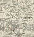
Deutsch: Topographischer Atlas vom Königreiche Baiern, Blatt Kempten (1836, Eisenbahn nachgetragen 1851 und 1853. Maßstab 1:50.000) |
| Date | |
| Source | http://bvbm1.bib-bvb.de/webclient/DeliveryManager?custom_att_2=simple_viewer&pid=226711&res=2&x=1779&y=2497 |
| Author | Topographisches Bureau München (reducirt und gezeichnet von Lieut. Lau. Berge gezeichnet von OberLieut. von Kienle. Berge gestochen von Fried. Kappel) |
Licensing
edit| Public domainPublic domainfalsefalse |
|
This work is in the public domain in its country of origin and other countries and areas where the copyright term is the author's life plus 100 years or fewer. | |
| This file has been identified as being free of known restrictions under copyright law, including all related and neighboring rights. | |
https://creativecommons.org/publicdomain/mark/1.0/PDMCreative Commons Public Domain Mark 1.0falsefalse
| Annotations InfoField | This image is annotated: View the annotations at Commons |
363
270
117
75
1467
862
"Lenzfried"
File history
Click on a date/time to view the file as it appeared at that time.
| Date/Time | Thumbnail | Dimensions | User | Comment | |
|---|---|---|---|---|---|
| current | 13:49, 28 February 2013 |  | 1,918 × 1,780 (1.83 MB) | Ratzer (talk | contribs) | größerer, vielfältig verwendbarer Kartenausschnitt (komplettes Gebiet der früheren Gemeinde Sankt Mang, Kempten) |
| 13:13, 14 February 2013 |  | 1,480 × 1,620 (1.14 MB) | Ratzer (talk | contribs) | {{Information |Description ={{de|1=Topographischer Atlas von Bayern, Blatt Kempten}} |Source =http://bvbm1.bib-bvb.de/webclient/DeliveryManager?custom_att_2=simple_viewer&pid=226711&res=2&x=1779&y=2497 |Author =Königlich Bayerisches... |
You cannot overwrite this file.
File usage on Commons
The following 2 pages use this file:
File usage on other wikis
The following other wikis use this file:
- Usage on de.wikipedia.org
- Usage on www.wikidata.org