File:Kerch strait bridge map.svg

Size of this PNG preview of this SVG file: 768 × 600 pixels. Other resolutions: 308 × 240 pixels | 615 × 480 pixels | 984 × 768 pixels | 1,280 × 999 pixels | 2,560 × 1,999 pixels | 821 × 641 pixels.
Original file (SVG file, nominally 821 × 641 pixels, file size: 225 KB)
Captions
Captions
Add a one-line explanation of what this file represents
Summary edit
| Description |
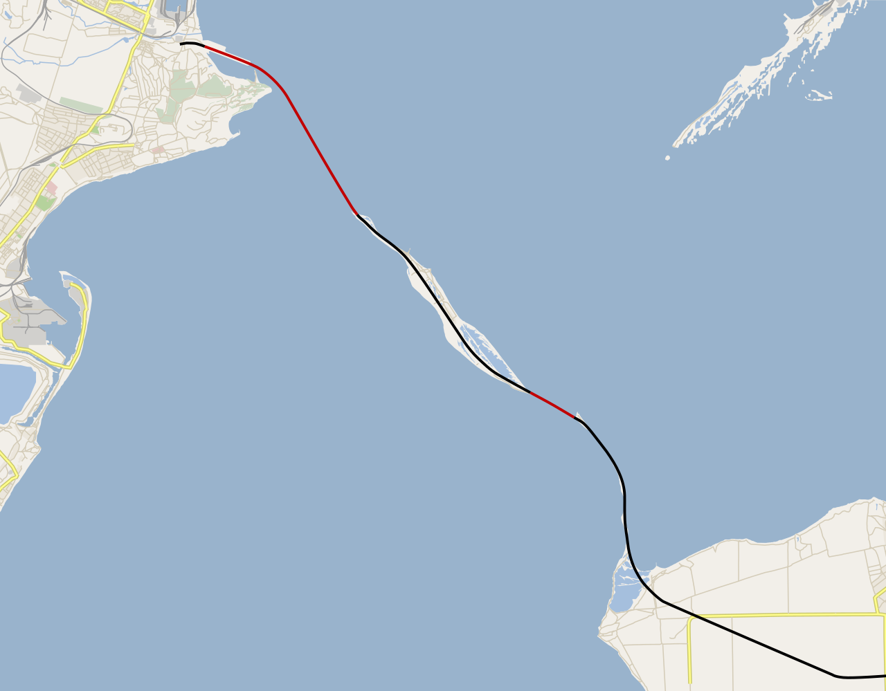
Русский: Карта нового моста через Керченский пролив (пока только заготовка карты).
Части моста, располагающиеся полностью над водой.
Части моста, располагающиеся полностью над сушей (Тузлинская коса). English: Kerch Strait bridge map, WIP.
Above-water parts of the bridge.
Above-surface parts of the bridge (Tuzla Spit). |
|||||||||
| Date | ||||||||||
| Source | Own work using Maperitive and Inkscape, based on OpenStreetMap data. | |||||||||
| Creator | ||||||||||
| Geotemporal data | ||||||||||
| Bounding box |
|
|||||||||
| Georeferencing | If inappropriate please set warp_status = skip to hide. | |||||||||
Licensing edit
I, the copyright holder of this work, hereby publish it under the following license:
This file is licensed under the Creative Commons Attribution-Share Alike 4.0 International license.
- You are free:
- to share – to copy, distribute and transmit the work
- to remix – to adapt the work
- Under the following conditions:
- attribution – You must give appropriate credit, provide a link to the license, and indicate if changes were made. You may do so in any reasonable manner, but not in any way that suggests the licensor endorses you or your use.
- share alike – If you remix, transform, or build upon the material, you must distribute your contributions under the same or compatible license as the original.
File history
Click on a date/time to view the file as it appeared at that time.
| Date/Time | Thumbnail | Dimensions | User | Comment | |
|---|---|---|---|---|---|
| current | 13:04, 1 June 2017 | | 821 × 641 (225 KB) | Nzeemin (talk | contribs) | updated OSM background |
| 21:22, 16 April 2016 |  | 821 × 641 (168 KB) | Nzeemin (talk | contribs) | Updated bridgeline and roads | |
| 18:16, 22 December 2015 |  | 821 × 641 (167 KB) | Nzeemin (talk | contribs) | More fixes. | |
| 13:52, 17 December 2015 |  | 821 × 641 (170 KB) | Nzeemin (talk | contribs) | Fixed the bridgeline and roadline. | |
| 16:38, 27 August 2015 |  | 821 × 641 (170 KB) | Nzeemin (talk | contribs) | Line split to bridges and roads. | |
| 19:43, 26 August 2015 |  | 821 × 641 (163 KB) | Nzeemin (talk | contribs) | User created page with UploadWizard |
You cannot overwrite this file.
File usage on Commons
The following 3 pages use this file:
File usage on other wikis
The following other wikis use this file:
- Usage on cs.wikipedia.org
- Usage on eo.wikipedia.org
- Usage on fi.wikipedia.org
- Usage on fr.wikipedia.org
- Usage on hu.wikipedia.org
- Usage on ru.wikipedia.org
- Usage on sv.wikipedia.org
- Usage on uk.wikiquote.org
- Usage on www.wikidata.org