File:Kerrera.jpg

Size of this preview: 800 × 600 pixels. Other resolutions: 320 × 240 pixels | 640 × 480 pixels | 1,024 × 768 pixels | 1,280 × 960 pixels | 2,560 × 1,920 pixels | 3,936 × 2,952 pixels.
Original file (3,936 × 2,952 pixels, file size: 4.1 MB, MIME type: image/jpeg)
Captions
Captions
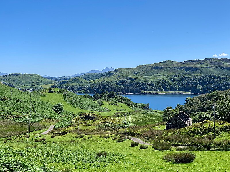
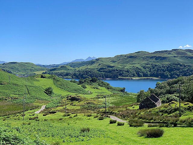
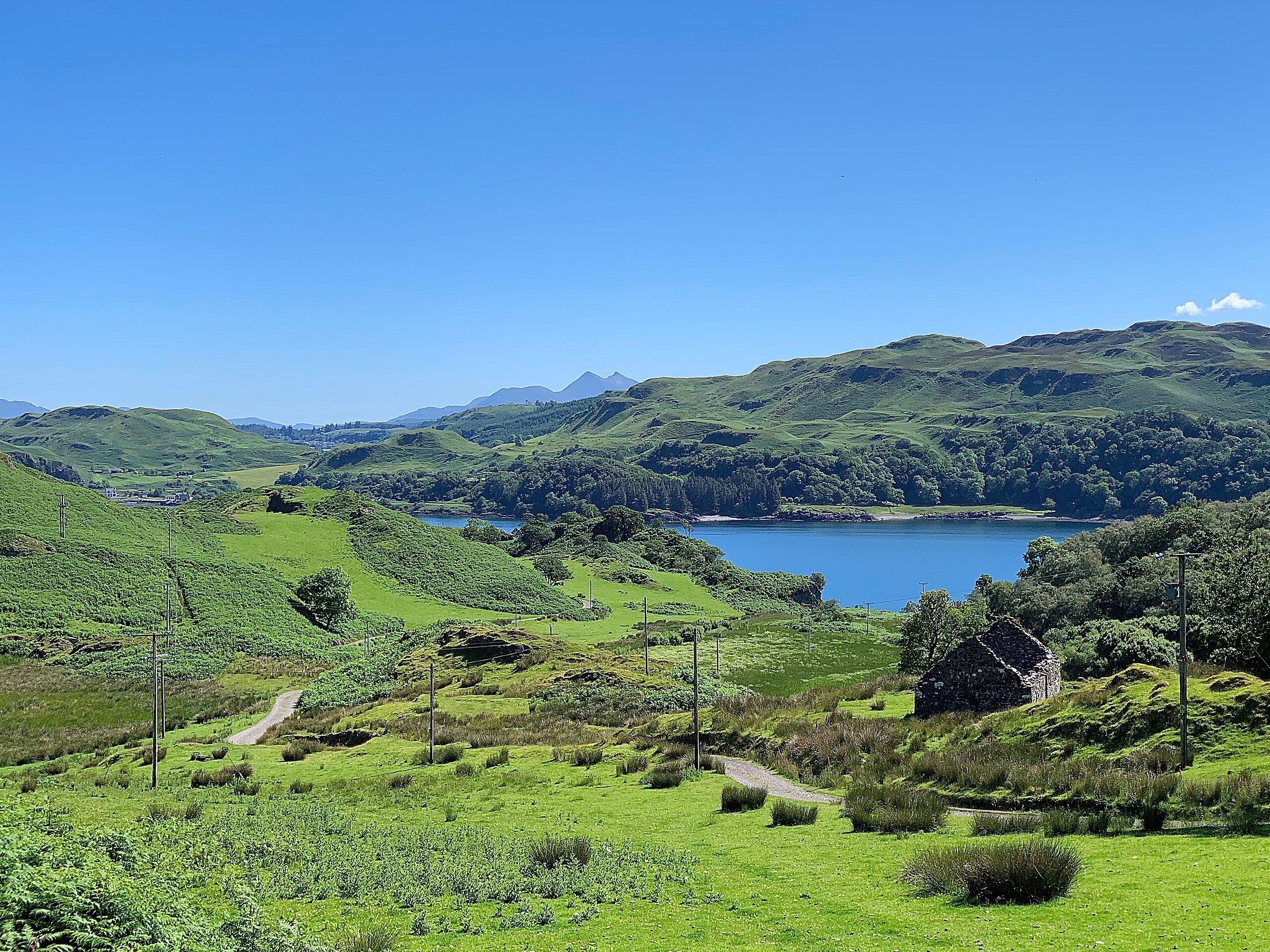
Island of Kerrera, Scotland
Summary
edit
| Description |
English: The beautiful small island of Kerrera lies just a five minute ferry ride from the Scottish mainland, between Oban and Mull. There are no paved roads, only farm tracks, and visitors aren't allowed to bring cars. The first transatlantic cable was laid from here to Newfoundland in 1956. The peaks of Stob Daimh and Ben Cruachan are visible in the distance. |
| Date | |
| Source | https://www.flickr.com/photos/91451979@N00/48151554666/ |
| Author | John Mason |
| Camera location | | View this and other nearby images on: OpenStreetMap |
|---|
Licensing
edit
This file is licensed under the Creative Commons Attribution 2.0 Generic license.
- You are free:
- to share – to copy, distribute and transmit the work
- to remix – to adapt the work
- Under the following conditions:
- attribution – You must give appropriate credit, provide a link to the license, and indicate if changes were made. You may do so in any reasonable manner, but not in any way that suggests the licensor endorses you or your use.
| This image was originally posted to Flickr by johnomason at https://flickr.com/photos/91451979@N00/48151554666. It was reviewed on 24 May 2024 by FlickreviewR 2 and was confirmed to be licensed under the terms of the cc-by-2.0. |
File history
Click on a date/time to view the file as it appeared at that time.
| Date/Time | Thumbnail | Dimensions | User | Comment | |
|---|---|---|---|---|---|
| current | 10:23, 24 May 2024 | | 3,936 × 2,952 (4.1 MB) | Atsirlin (talk | contribs) | Uploaded a work by John Mason from https://www.flickr.com/photos/91451979@N00/48151554666/ with UploadWizard |
You cannot overwrite this file.
File usage on Commons
There are no pages that use this file.
File usage on other wikis
The following other wikis use this file:
- Usage on ru.wikivoyage.org