File:Kettle-River-Range NASA-MODIS 11Aug2001.jpg

Size of this preview: 800 × 496 pixels. Other resolutions: 320 × 199 pixels | 640 × 397 pixels | 1,024 × 635 pixels | 1,586 × 984 pixels.
Original file (1,586 × 984 pixels, file size: 874 KB, MIME type: image/jpeg)
Captions
Captions
Add a one-line explanation of what this file represents
Summary edit
| Description |
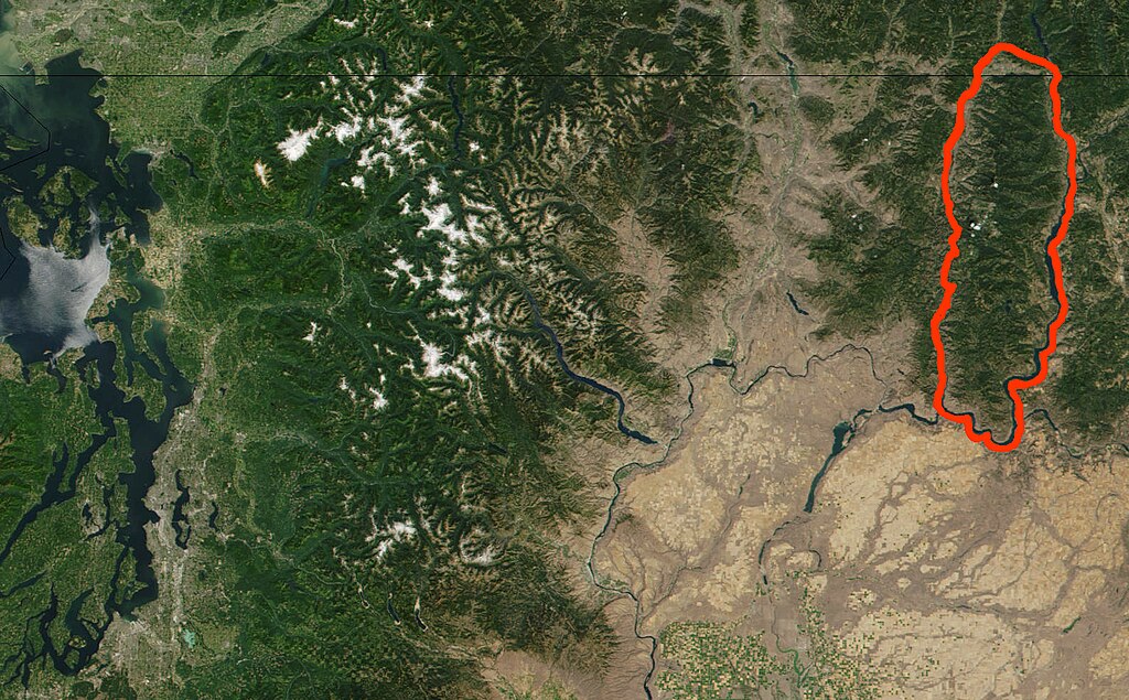
English: Kettle River Range (outined in red) and north central Washington State (USA), and southern edge of British Columbia (Canada), from cropped and modified NASA True Color MODIS satellite photograph image from NASA Visible Earth Collection. Original Image: Washington.A2001223.1920.250m.jpg (3600x4800) |
| Date | |
| Source | http://visibleearth.nasa.gov/view.php?id=56573 |
| Author | NASA Visible Earth, original credit: Jacques Descloitres, MODIS Land Rapid Response Team |
| Permission (Reusing this file) |
Public domain |
Licensing edit
| This file is in the public domain in the United States because it was solely created by NASA. NASA copyright policy states that "NASA material is not protected by copyright unless noted". (See Template:PD-USGov, NASA copyright policy page or JPL Image Use Policy.) | ||
 |
Warnings:
|
File history
Click on a date/time to view the file as it appeared at that time.
| Date/Time | Thumbnail | Dimensions | User | Comment | |
|---|---|---|---|---|---|
| current | 11:16, 4 March 2012 | | 1,586 × 984 (874 KB) | Charvex (talk | contribs) | {{Information |Description ={{en|1=Kettle River Range (outined in red) and north central Washington State (USA), and southern edge of British Columbia (Canada), from cropped and modified NASA True Color MODIS satellite photograph image from NASA Vis... |
You cannot overwrite this file.
File usage on Commons
There are no pages that use this file.
File usage on other wikis
The following other wikis use this file:
- Usage on arz.wikipedia.org
- Usage on ceb.wikipedia.org
- Usage on cs.wikipedia.org
- Usage on de.wikipedia.org
- Usage on en.wikipedia.org
- Usage on www.wikidata.org