File:Killywhan railway station (site), Dumfries & Galloway (geograph 6161076).jpg
,_Dumfries_%26_Galloway_(geograph_6161076).jpg&redirect=no)
Size of this preview: 800 × 600 pixels. Other resolutions: 320 × 240 pixels | 640 × 480 pixels | 1,024 × 768 pixels | 1,280 × 960 pixels | 1,600 × 1,200 pixels.
Original file (1,600 × 1,200 pixels, file size: 516 KB, MIME type: image/jpeg)
Captions
Captions
Add a one-line explanation of what this file represents
Summary edit
,_Dumfries_%26_Galloway_(geograph_6161076).jpg&action=edit§ion=1)
| Description |
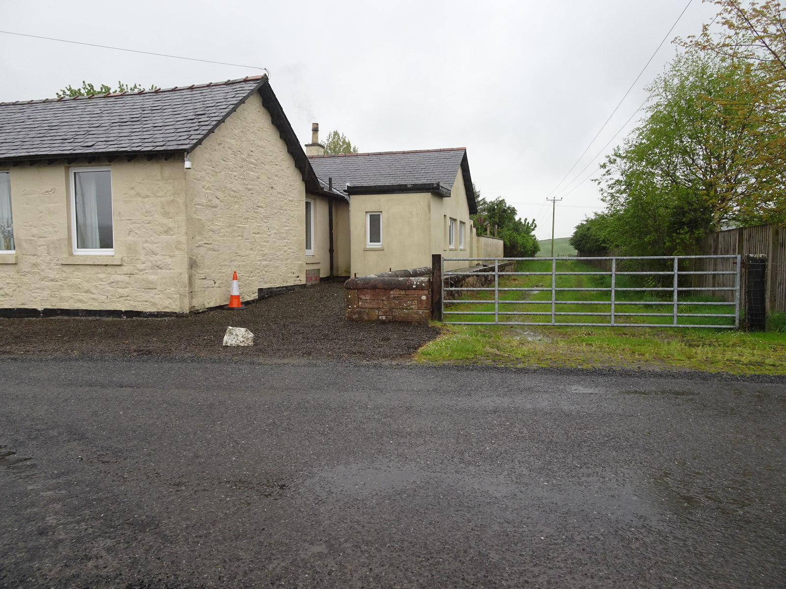
English: Killlywhan railway station (site), Dumfries & Galloway Opened in 1859 by the Castle Douglas & Dumfries Railway, later part of the Glasgow & South Western Railway, this station closed to passengers in 1959 and completely in 1965. The railway line was known as 'The Port Road'. View south west towards Kirkgunzeon and Castle Douglas. |
| Date | |
| Source | From geograph.org.uk |
| Author | Nigel Thompson |
| Permission (Reusing this file) |
Creative Commons Attribution Share-alike license 2.0 |
| Attribution (required by the license) | Nigel Thompson / Killlywhan railway station (site), Dumfries & Galloway / |
| Camera location | | View this and other nearby images on: OpenStreetMap |
|---|
,_Dumfries_%26_Galloway_(geograph_6161076).jpg¶ms=055.006625_N_-003.738963_E_globe:Earth_type:camera_source:geograph-osgb36(NX88886939)_heading:225.00&language=en)
| Object location | | View this and other nearby images on: OpenStreetMap |
|---|
,_Dumfries_%26_Galloway_(geograph_6161076).jpg¶ms=055.006440_N_-003.739270_E_globe:Earth_class:object_type:object_source:geograph-osgb36(NX88866937)_heading:225.00&language=en)
Licensing edit
,_Dumfries_%26_Galloway_(geograph_6161076).jpg&action=edit§ion=2)

|
This image was taken from the Geograph project collection. See this photograph's page on the Geograph website for the photographer's contact details. The copyright on this image is owned by Nigel Thompson and is licensed for reuse under the Creative Commons Attribution-ShareAlike 2.0 license.
|
This file is licensed under the Creative Commons Attribution-Share Alike 2.0 Generic license.
Attribution: Nigel Thompson
- You are free:
- to share – to copy, distribute and transmit the work
- to remix – to adapt the work
- Under the following conditions:
- attribution – You must give appropriate credit, provide a link to the license, and indicate if changes were made. You may do so in any reasonable manner, but not in any way that suggests the licensor endorses you or your use.
- share alike – If you remix, transform, or build upon the material, you must distribute your contributions under the same or compatible license as the original.
File history
Click on a date/time to view the file as it appeared at that time.
| Date/Time | Thumbnail | Dimensions | User | Comment | |
|---|---|---|---|---|---|
| current | 16:35, 4 January 2020 | | 1,600 × 1,200 (516 KB) | Lamberhurst (talk | contribs) | Transferred from geograph.co.uk using [https://tools.wmflabs.org/geograph2commons/ geograph2commons] |
You cannot overwrite this file.
File usage on Commons
The following 2 pages use this file:
,_Dumfries_%26_Galloway_(geograph_6161076).jpg&oldid=737052555)