File:Killywhan station site geograph-3719822-by-Ben-Brooksbank.jpg
Size of this preview: 800 × 472 pixels. Other resolutions: 320 × 189 pixels | 640 × 377 pixels | 1,024 × 604 pixels | 1,280 × 755 pixels | 2,359 × 1,391 pixels.
Original file (2,359 × 1,391 pixels, file size: 2.54 MB, MIME type: image/jpeg)
Captions
Captions
Add a one-line explanation of what this file represents
Summary edit
| Description |
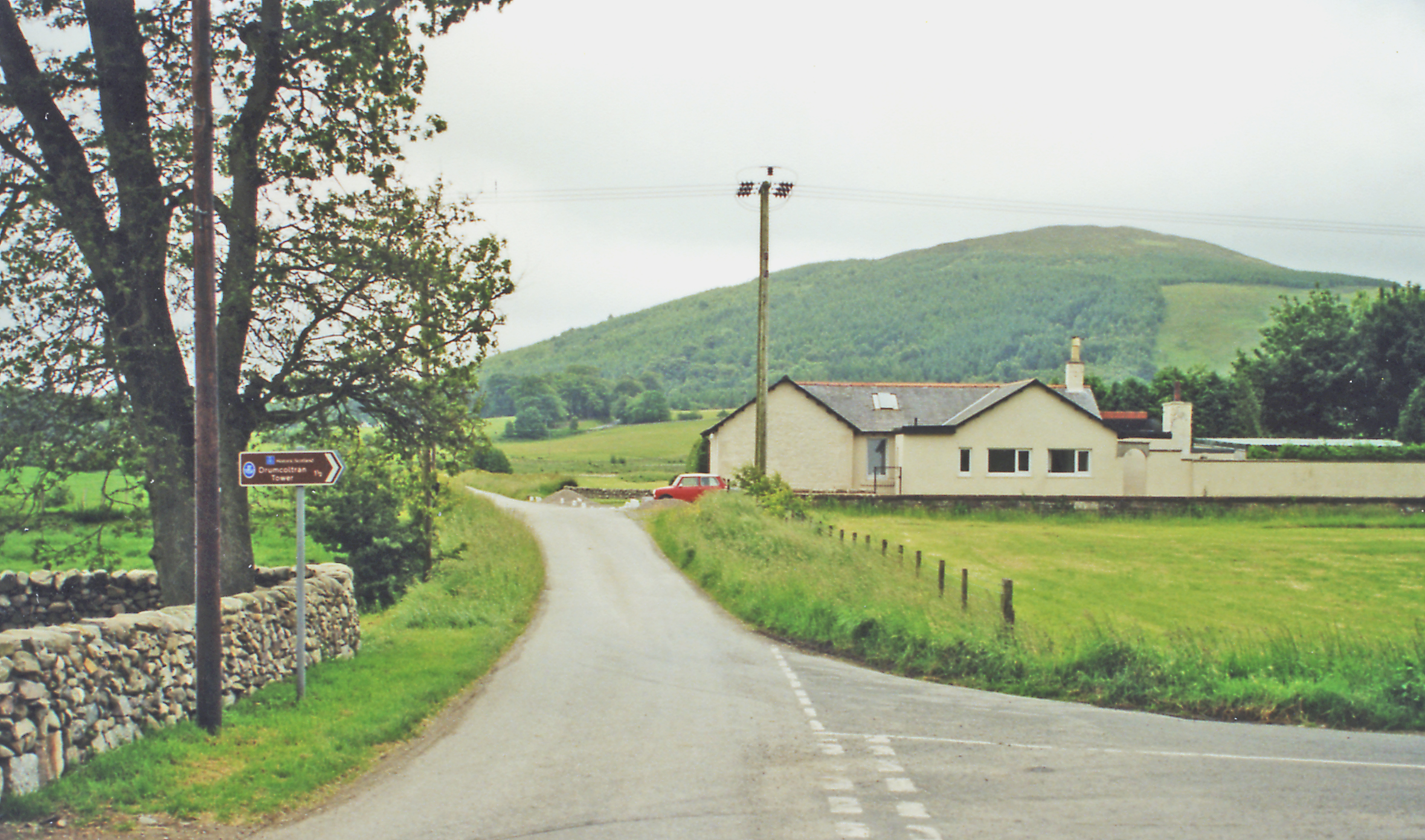
English: Site of former Killywhan station. View SE: until 14/6/65 the main line (Carlisle) - Dumfries (to left) - Castle Douglas - Stranraer crossed here, Killwhan station (on the right) having been closed 3/8/59. Behind is Lotus Hill (1,000 ft.). |
| Date | |
| Source | From geograph.org.uk |
| Author | Ben Brooksbank |
| Permission (Reusing this file) |
Creative Commons Attribution Share-alike license 2.0 |
| Attribution (required by the license) | Ben Brooksbank / Site of former Killywhan station / |
| Camera location | | View this and other nearby images on: OpenStreetMap |
|---|
Licensing edit

|
This image was taken from the Geograph project collection. See this photograph's page on the Geograph website for the photographer's contact details. The copyright on this image is owned by Ben Brooksbank and is licensed for reuse under the Creative Commons Attribution-ShareAlike 2.0 license.
|
This file is licensed under the Creative Commons Attribution-Share Alike 2.0 Generic license.
Attribution: Ben Brooksbank
- You are free:
- to share – to copy, distribute and transmit the work
- to remix – to adapt the work
- Under the following conditions:
- attribution – You must give appropriate credit, provide a link to the license, and indicate if changes were made. You may do so in any reasonable manner, but not in any way that suggests the licensor endorses you or your use.
- share alike – If you remix, transform, or build upon the material, you must distribute your contributions under the same or compatible license as the original.
File history
Click on a date/time to view the file as it appeared at that time.
| Date/Time | Thumbnail | Dimensions | User | Comment | |
|---|---|---|---|---|---|
| current | 14:12, 5 December 2013 | | 2,359 × 1,391 (2.54 MB) | Chevin (talk | contribs) | == {{int:filedesc}} == {{Information |Description={{en|1='''Site of former Killywhan station.'''<br/> View SE: until 14/6/65 the main line (Carlisle) - Dumfries (to left) - Castle Douglas - Stranraer crossed here, Killwhan station (on the right) having... |
You cannot overwrite this file.
File usage on Commons
The following 2 pages use this file:
File usage on other wikis
The following other wikis use this file:
- Usage on en.wikipedia.org
- Usage on www.wikidata.org