File:Kiriwina Group (Trobriand Islands) 1891 map nla.obj-231909085-1.jpg

Size of this preview: 488 × 600 pixels. Other resolutions: 195 × 240 pixels | 390 × 480 pixels | 625 × 768 pixels | 833 × 1,024 pixels | 1,666 × 2,048 pixels | 5,000 × 6,147 pixels.
Original file (5,000 × 6,147 pixels, file size: 11.13 MB, MIME type: image/jpeg)
Captions
Captions
Add a one-line explanation of what this file represents
Summary
edit| Description |
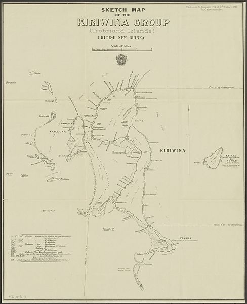
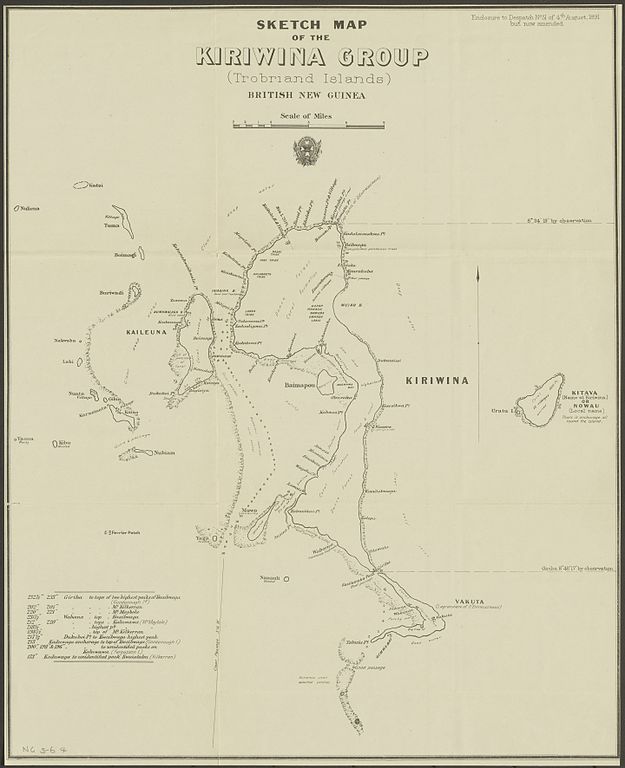
English: map of the Trobriand Islands, Papua New Guinea |
| Date | circa 1891 |
| Source | nla.gov.au/nla.obj-231909085 |
| Author | Queensland. Surveyor General's Office |
| Other versions |
|
_1891_map_nla_obj-231909085-1_(retouched).jpg)
_1891_map_nla.obj-231909085-1.jpg&action=edit§ion=1)
Licensing
edit_1891_map_nla.obj-231909085-1.jpg&action=edit§ion=2)
|
This work is in the public domain in its country of origin and other countries and areas where the copyright term is the author's life plus 70 years or fewer. This work is in the public domain in the United States because it was published (or registered with the U.S. Copyright Office) before January 1, 1929. | |
| This file has been identified as being free of known restrictions under copyright law, including all related and neighboring rights. | |
File history
Click on a date/time to view the file as it appeared at that time.
| Date/Time | Thumbnail | Dimensions | User | Comment | |
|---|---|---|---|---|---|
| current | 13:37, 5 October 2016 | | 5,000 × 6,147 (11.13 MB) | Ratzer (talk | contribs) | User created page with UploadWizard |
You cannot overwrite this file.
File usage on Commons
The following page uses this file:
File usage on other wikis
The following other wikis use this file:
- Usage on de.wikipedia.org
_1891_map_nla.obj-231909085-1.jpg&oldid=859655585)