File:Kokoda trail location.svg

Size of this PNG preview of this SVG file: 680 × 599 pixels. Other resolutions: 272 × 240 pixels | 545 × 480 pixels | 871 × 768 pixels | 1,162 × 1,024 pixels | 2,323 × 2,048 pixels | 709 × 625 pixels.
Original file (SVG file, nominally 709 × 625 pixels, file size: 30 KB)
Captions
Captions
Add a one-line explanation of what this file represents
Summary
edit
| Description |
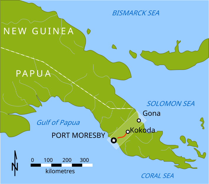
English: Map of New Guinea territories 1942, showing location of Kokoda Trail, scale in km |
| Date | |
| Source | Own work |
| Author | SpoolWhippets |
| Other versions | Png_potts.png |
Licensing
edit
| I, the copyright holder of this work, release this work into the public domain. This applies worldwide. In some countries this may not be legally possible; if so: I grant anyone the right to use this work for any purpose, without any conditions, unless such conditions are required by law. |
File history
Click on a date/time to view the file as it appeared at that time.
| Date/Time | Thumbnail | Dimensions | User | Comment | |
|---|---|---|---|---|---|
| current | 05:43, 11 March 2010 | | 709 × 625 (30 KB) | SpoolWhippets (talk | contribs) | {{Information |Description={{en|1=Map of New Guinea territories 1942, showing location of Kokoda Trail, scale in km}} |Source={{own}} |Author=SpoolWhippets |Date=2010-03-11 |Permission= |other_versions=Png_potts.png }} [[Category:P |
You cannot overwrite this file.
File usage on Commons
The following page uses this file:
File usage on other wikis
The following other wikis use this file:
- Usage on www.wikidata.org