File:Kolky, 1917, map.jpg
Size of this preview: 600 × 600 pixels. Other resolutions: 240 × 240 pixels | 480 × 480 pixels | 790 × 790 pixels.
Original file (790 × 790 pixels, file size: 366 KB, MIME type: image/jpeg)
Captions
Captions
Add a one-line explanation of what this file represents
Summary edit
| Description |
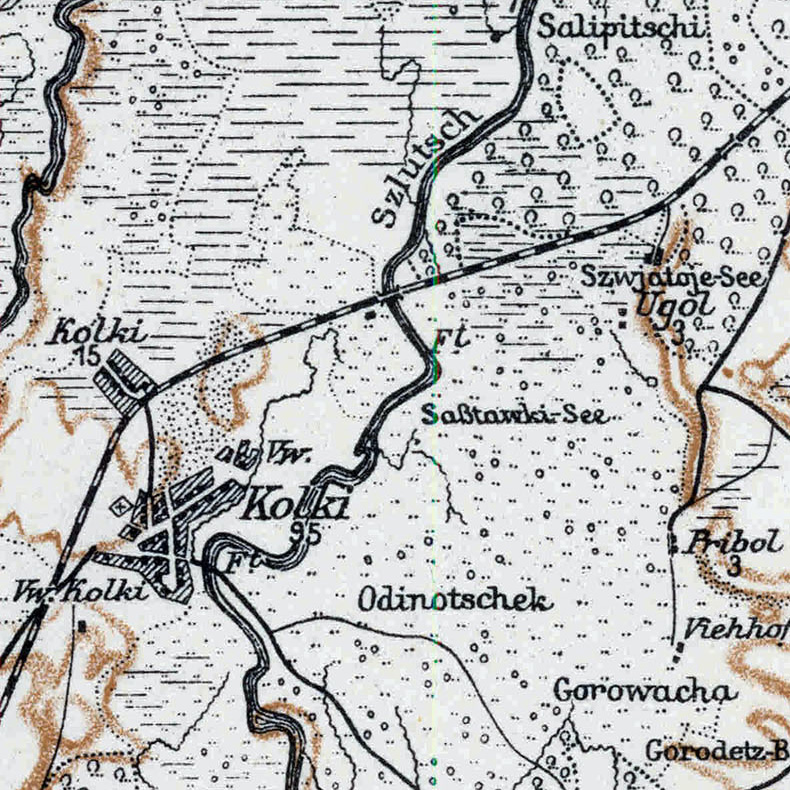
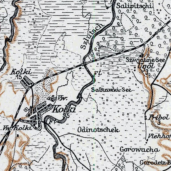
English: Kolky on the map "Karte des Westlichen Russlands", T 35, 1917. According to Digital Repository of Scientific Institutes and Kujawsko-Pomorska Digital Library the map is in the public domain.
Українська: Колки на карті "Karte des Westlichen Russlands", T 35, 1917. |
| Date | |
| Source | MAPSTER |
| Author | Prusy. Königliche Preussische Landesaufnahme Kartographische Abteilung |
Licensing edit
|
This work is in the public domain in its country of origin and other countries and areas where the copyright term is the author's life plus 70 years or fewer. This work is in the public domain in the United States because it was published (or registered with the U.S. Copyright Office) before January 1, 1929. | |
| This file has been identified as being free of known restrictions under copyright law, including all related and neighboring rights. | |
File history
Click on a date/time to view the file as it appeared at that time.
| Date/Time | Thumbnail | Dimensions | User | Comment | |
|---|---|---|---|---|---|
| current | 13:15, 9 November 2019 | | 790 × 790 (366 KB) | ZxcvU (talk | contribs) |
You cannot overwrite this file.
File usage on Commons
The following page uses this file:
File usage on other wikis
The following other wikis use this file:
- Usage on uk.wikipedia.org