File:Komodo Padar Rinca.png

Size of this preview: 634 × 599 pixels. Other resolutions: 254 × 240 pixels | 508 × 480 pixels | 813 × 768 pixels | 1,083 × 1,024 pixels | 1,845 × 1,744 pixels.
Original file (1,845 × 1,744 pixels, file size: 3.1 MB, MIME type: image/png)
Captions
Captions
Add a one-line explanation of what this file represents
| Description |
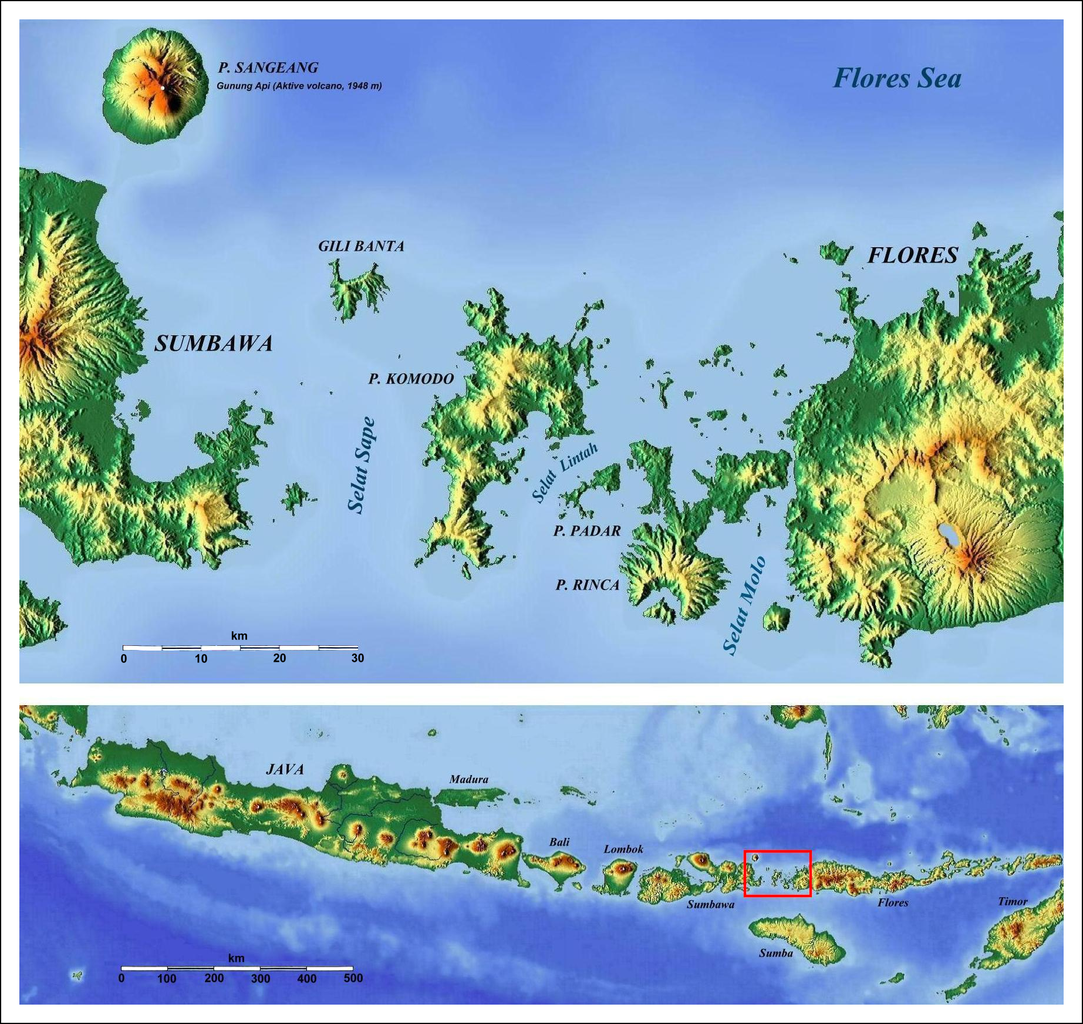
Deutsch: Komodo, Padar, Rinca. Topografische Übersichtskarte |
||
| Date | |||
| Source |
Deutsch: Google-maps-for-free http://www.maps-for-free.com/ . Änderungen und Ergänzungen von Geoethno |
||
| Author |
|
||
| Permission (Reusing this file) |
|

Original upload log
edit
The original description page was here. All following user names refer to de.wikipedia.
- 2011-02-18 01:55 Geoethno 1845×1744× (3252471 bytes) {{Information |Beschreibung = Komodo, Padar, Rinca. Topografische Übersichtskarte |Quelle = Google-maps-for-free http://www.maps-for-free.com/ . Änderungen und Ergänzungen von Geoethno |Urheber = Geoethno |Datum = 2011
File history
Click on a date/time to view the file as it appeared at that time.
| Date/Time | Thumbnail | Dimensions | User | Comment | |
|---|---|---|---|---|---|
| current | 01:23, 19 February 2011 | | 1,845 × 1,744 (3.1 MB) | File Upload Bot (Magnus Manske) (talk | contribs) | {{BotMoveToCommons|de.wikipedia|year={{subst:CURRENTYEAR}}|month={{subst:CURRENTMONTHNAME}}|day={{subst:CURRENTDAY}}}} {{Information |Description={{de|Komodo, Padar, Rinca. Topografische Übersichtskarte}} |Source=Transferred from [http://de.wikipedia.or |
You cannot overwrite this file.
File usage on Commons
There are no pages that use this file.
File usage on other wikis
The following other wikis use this file:
- Usage on az.wikipedia.org
- Usage on bg.wikipedia.org
- Usage on cs.wikipedia.org
- Usage on de.wikipedia.org
- Usage on de.wikivoyage.org
- Usage on eo.wikipedia.org
- Usage on es.wikipedia.org
- Usage on he.wikipedia.org
- Usage on hu.wikipedia.org
- Usage on mrj.wikipedia.org
- Usage on nds.wikipedia.org
- Usage on nl.wikipedia.org
- Usage on uk.wikipedia.org