File:Kourou carte map 1776.jpg
Original file (1,055 × 1,082 pixels, file size: 343 KB, MIME type: image/jpeg)
Captions
Captions
Summary
edit
| Description |
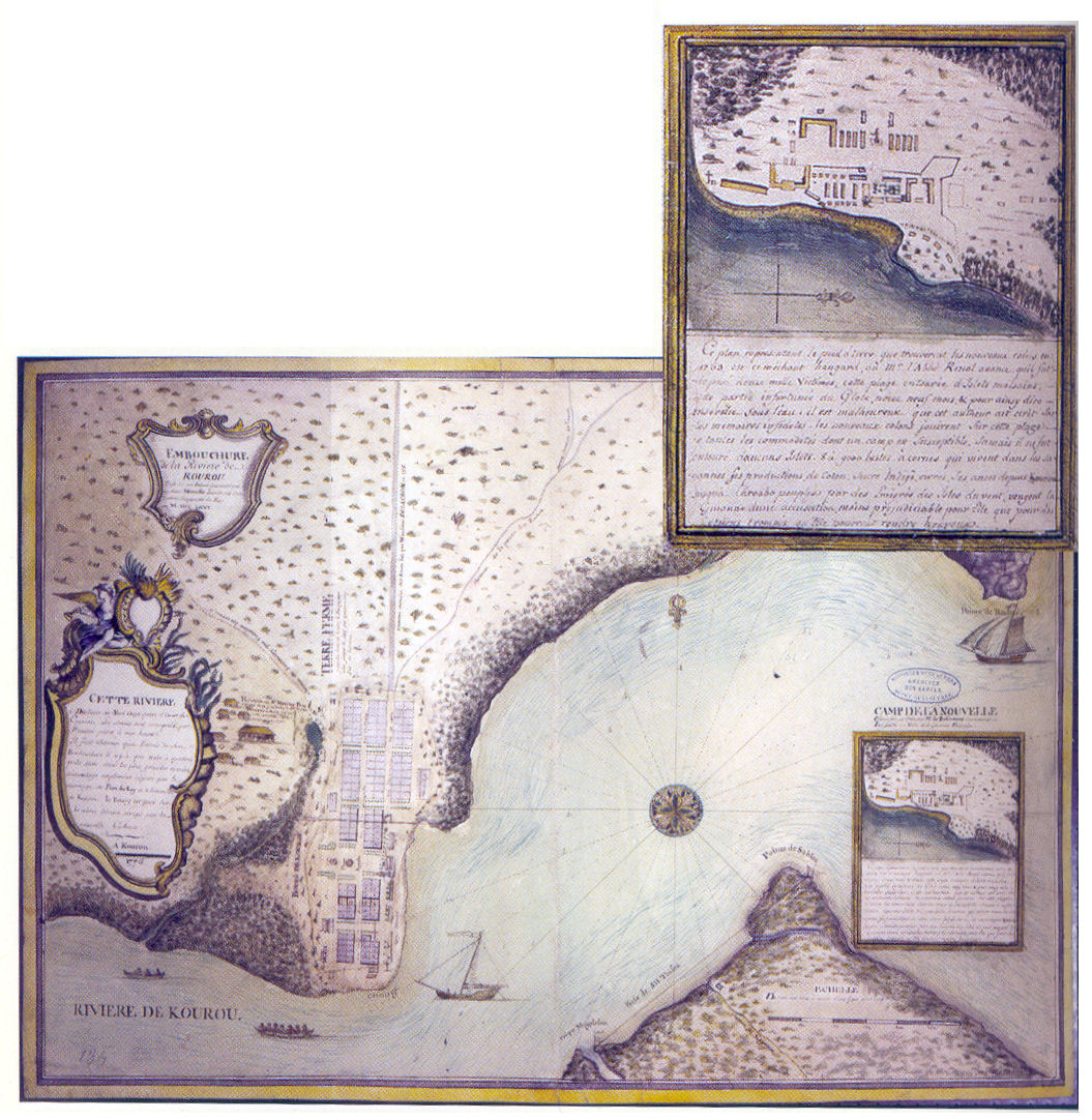
English: Map showing Kourou in 1776 and detail of the expedition camp as planned by Brûletout de Préfontaine in 1763, before the arrival of the colonists.
Français : Carte montrant le bourg de Kourou en 1776 et un détail du camp de l'expédition comme prévu par Brûletout de Préfontaine en 1763, avant l'arrivée des colons. |
| Date | early 1776 |
| Source | Bernard Montabo ; Le Grand livre de l'histoire de la Guyane ; volume I ; Collection Le Grand Livre ; Éditions Orphie, 2004. |
| Author | Unknown author |
| Permission (Reusing this file) |
PD-old |
Licensing
edit
|
This work is in the public domain in its country of origin and other countries and areas where the copyright term is the author's life plus 70 years or fewer.
| |
| This file has been identified as being free of known restrictions under copyright law, including all related and neighboring rights. | |
File history
Click on a date/time to view the file as it appeared at that time.
| Date/Time | Thumbnail | Dimensions | User | Comment | |
|---|---|---|---|---|---|
| current | 18:34, 10 June 2007 | | 1,055 × 1,082 (343 KB) | Arria Belli (talk | contribs) | {{Information |Description= {{en|Map showing Kourou and detail of the expedition camp as planned by Brûletout de Préfontaine before the arrival of the colonists.}} {{fr|Carte montrant le bourg de Kourou et un détail du camp de l'expédition com |
You cannot overwrite this file.
File usage on Commons
The following page uses this file:
File usage on other wikis
The following other wikis use this file:
- Usage on fr.wikipedia.org
- Usage on ja.wikipedia.org