File:Koziegłowy, 1965-08-23.png
Size of this preview: 800 × 536 pixels. Other resolutions: 320 × 214 pixels | 640 × 429 pixels | 861 × 577 pixels.
Original file (861 × 577 pixels, file size: 440 KB, MIME type: image/png)
Captions
Captions
Add a one-line explanation of what this file represents
Summary
edit
| Description |
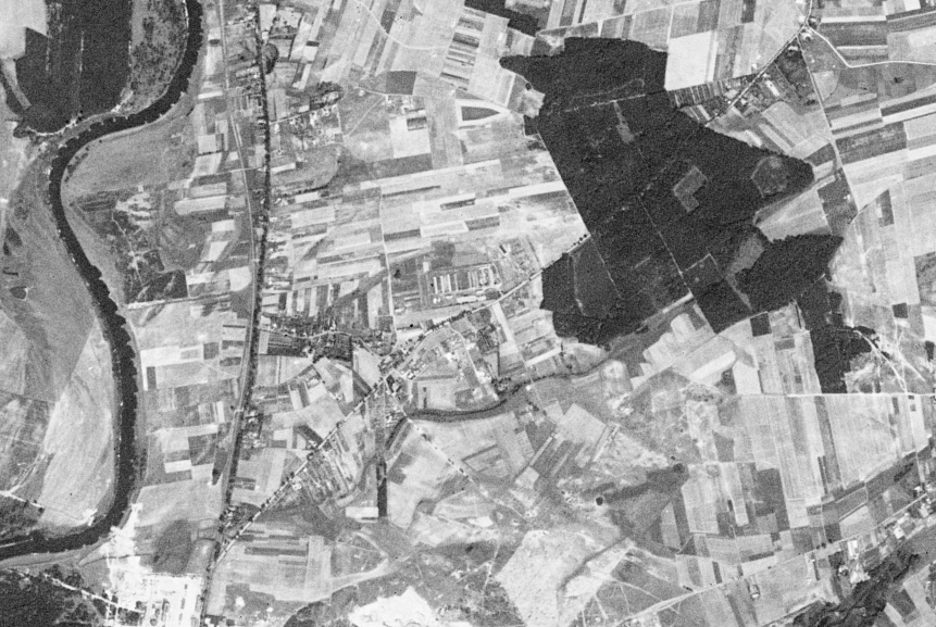
Polski: Koziegłowy i okolice sfotografowane przez amerykańskiego satelitę wywiadowczego KH-4A 1023, 23 sierpnia 1965 r.
Widoczne tereny przy Warcie zajmowane współcześnie przez centralną oczyszczalnię ścieków dla Poznania (między Wartą a drogą nr 196 przebiegającej w kierunku północ-południe), jak i brak linii kolejowej. W prawym dolnym rogu wieś Bogucin. W prawym górnym, Kicin. |
| Date | |
| Source | US Geological Survey via Wikigrant no. WG 2014-52 |
| Author | USAF / CIA / NRO |
Licensing
edit
| This work originally came from a National Reconnaissance Office (NRO) website or publication and has been specifically released into the public domain in the United States. Unless specifically released, NRO information should be assumed to be classified. The NRO seal is usage-restricted. See the site policy security notice and the site policy copyright notice for more information. Please note that if a copyright is indicated on a photo, graphic, or any other material, permission to copy these materials must be obtained from the original source.[1] |

|
The making of this document was supported by Wikimedia Polska Association, within Wikigrant no. WG 2014-52.
|
File history
Click on a date/time to view the file as it appeared at that time.
| Date/Time | Thumbnail | Dimensions | User | Comment | |
|---|---|---|---|---|---|
| current | 16:13, 2 November 2014 | | 861 × 577 (440 KB) | NH2501 (talk | contribs) | User created page with UploadWizard |
You cannot overwrite this file.
File usage on Commons
The following page uses this file:
File usage on other wikis
The following other wikis use this file:
- Usage on ceb.wikipedia.org
- Usage on ce.wikipedia.org
- Usage on pl.wikipedia.org
- Usage on tt.wikipedia.org
- Usage on www.wikidata.org